

Bespoke Cartography and Data Visualisation by Emory Beck
I present an ever-growing collection of images, made by ©Maphustle, a pseudonym of the hustle one goes through turning a hobby into something more.
This portfolio is dedicated to the creation of visualisations depicting the real world through the use of real-world data. I primarily work with LiDAR data, elevation models, aerial and satellite imagery. The goal is to bridge data, science and art.
If you like what you see, I also do commission work. Please get in touch via the commissions tab at the top of this page.
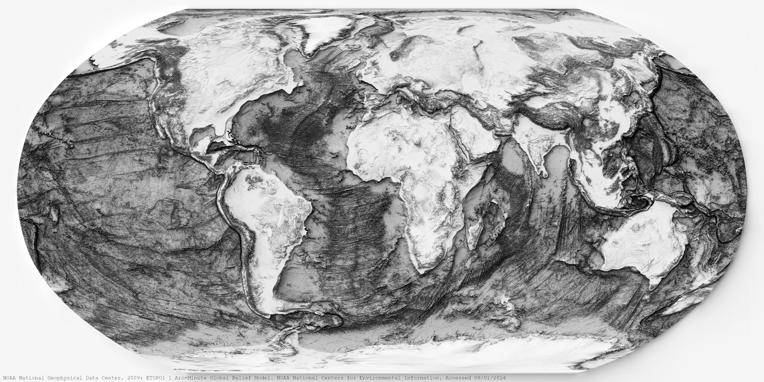
NOAA global relief model

Miramar Peninsula, Wellington - New Zealand

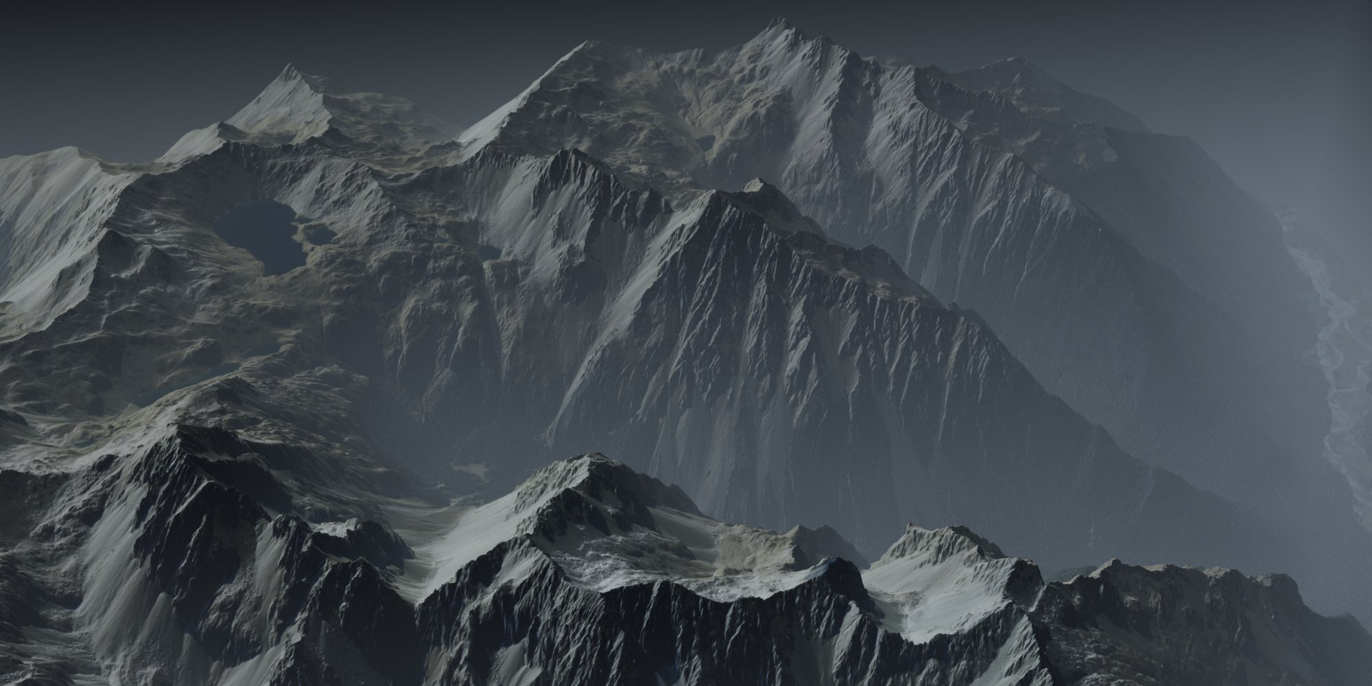
Taranaki Maunga, Taranaki - New Zealand
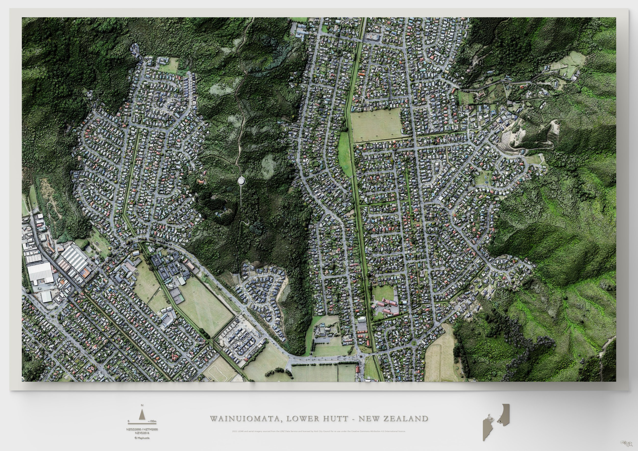
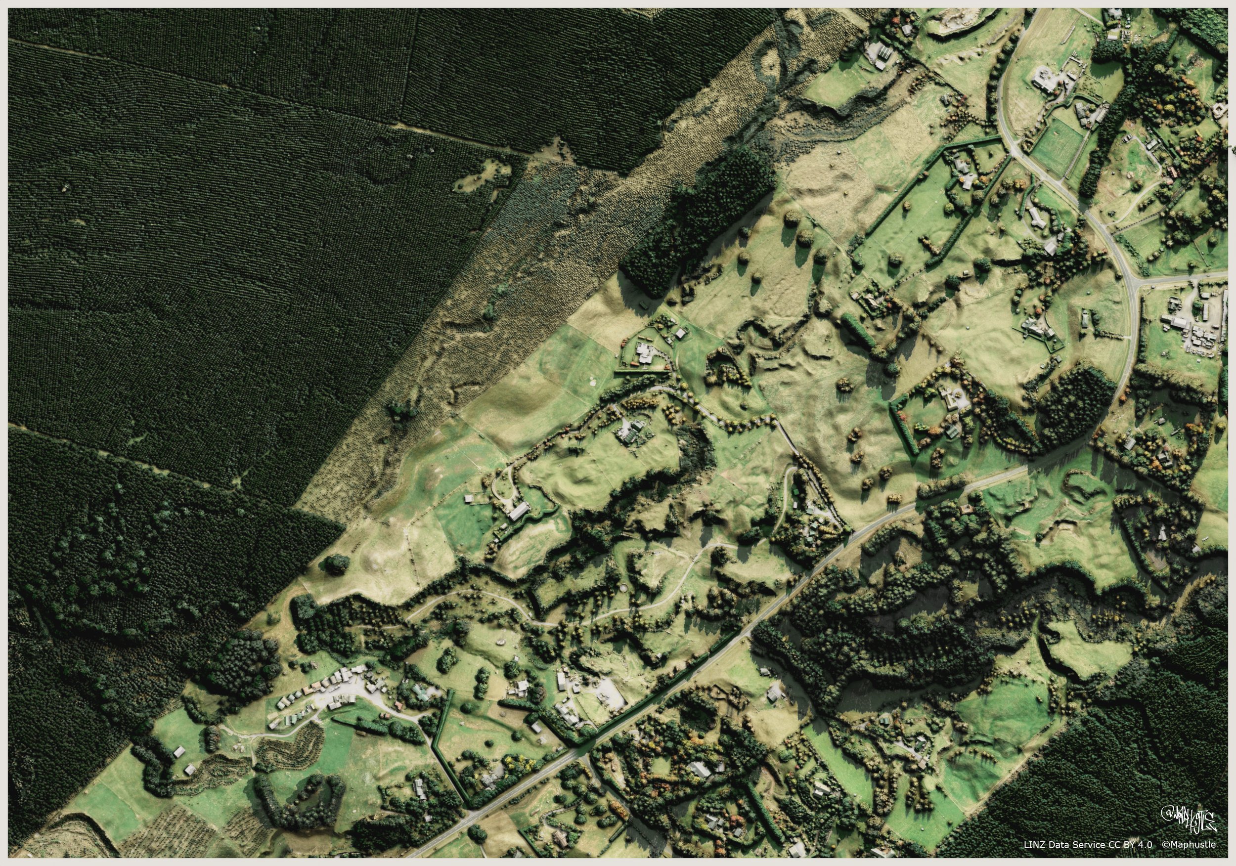
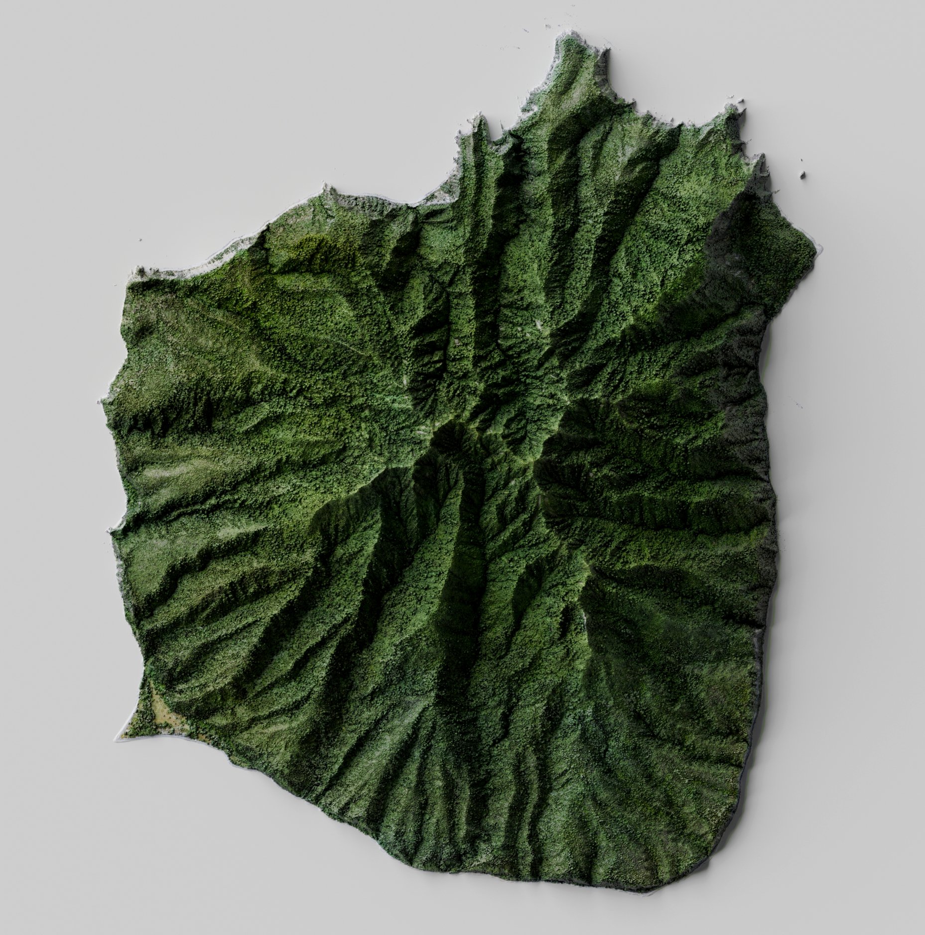
Wainuiomata, Lower Hutt - New Zealand

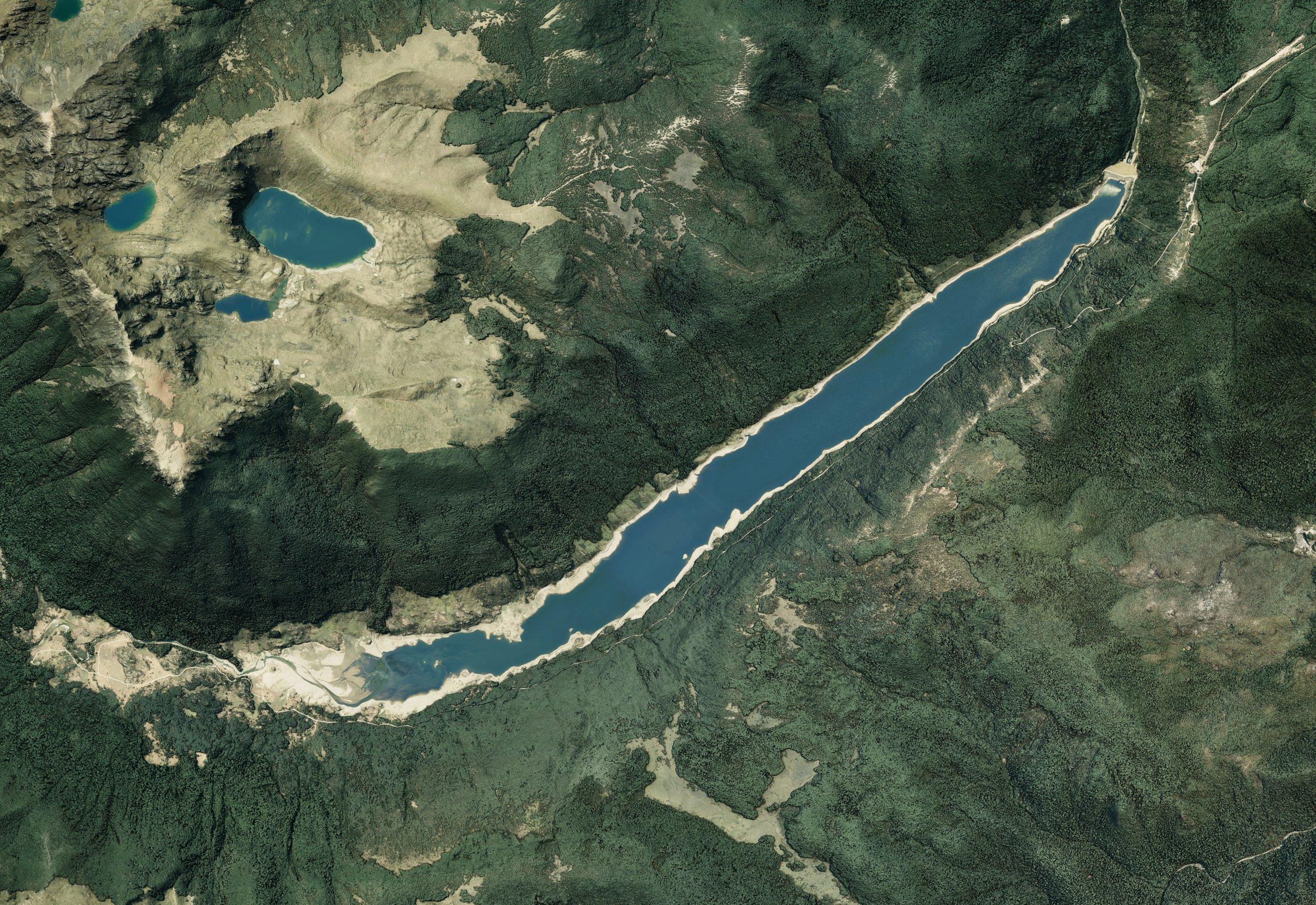
Cobb Valley, Tasman - New Zealand

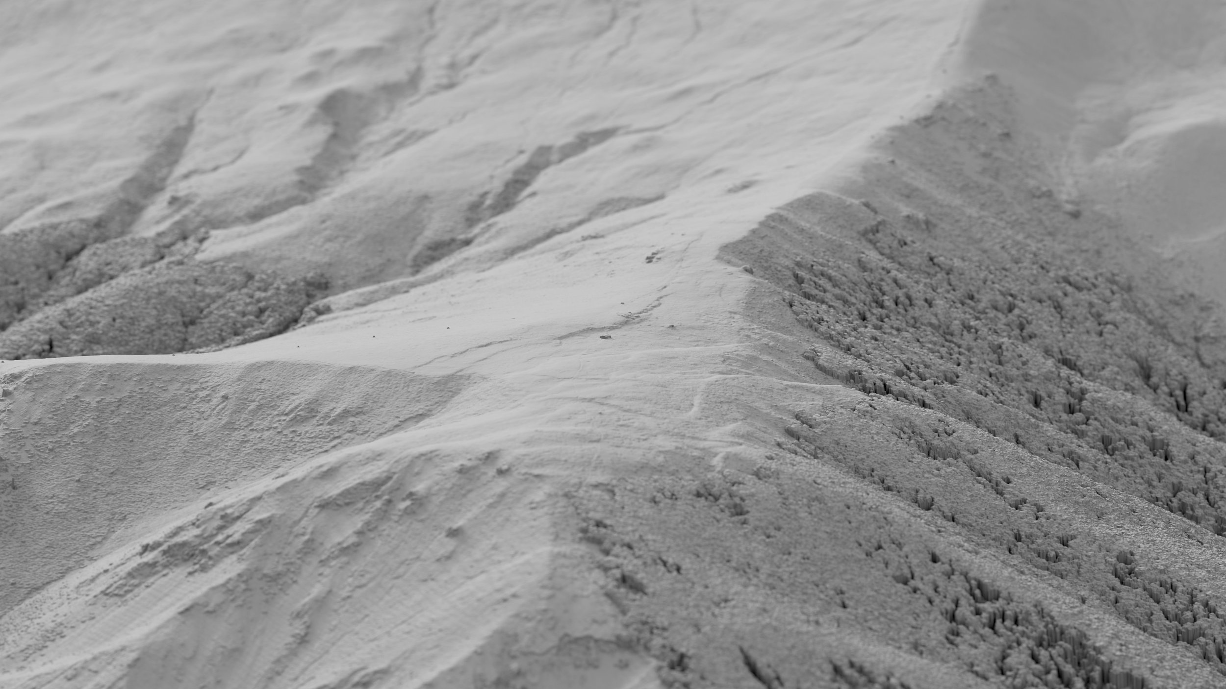
Barker Hut, Arthur's Park National Park - New Zealand
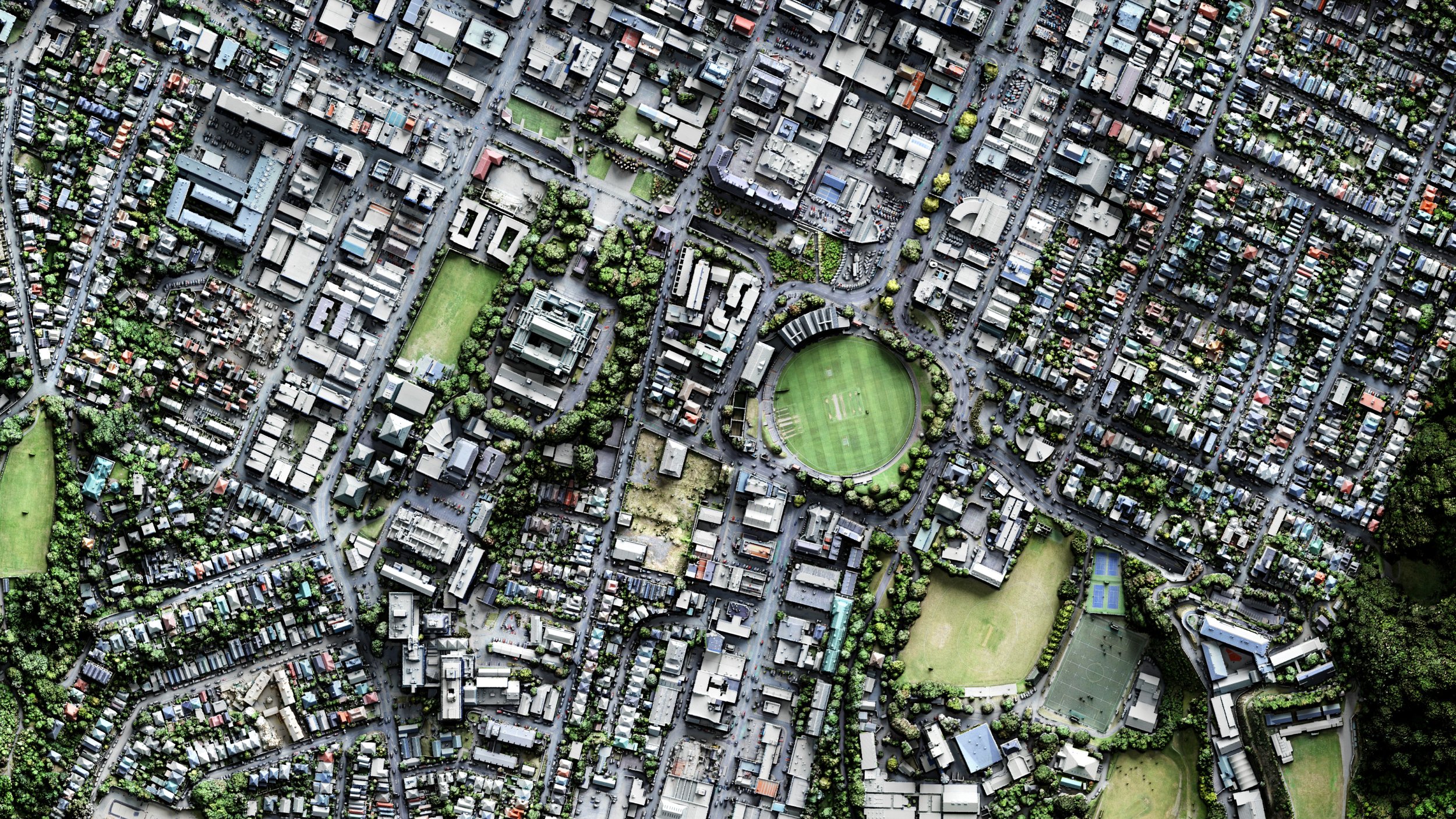
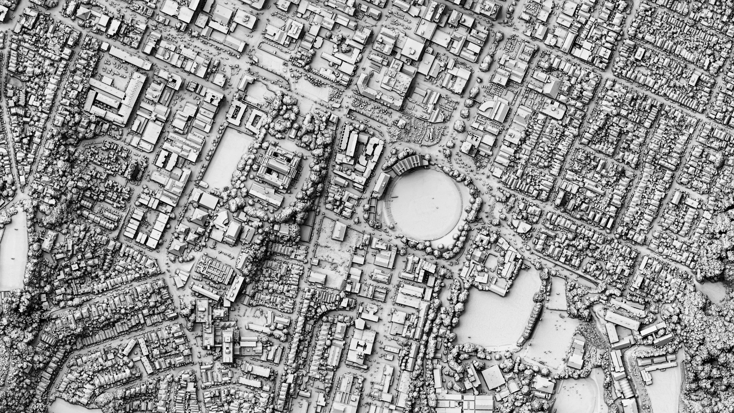
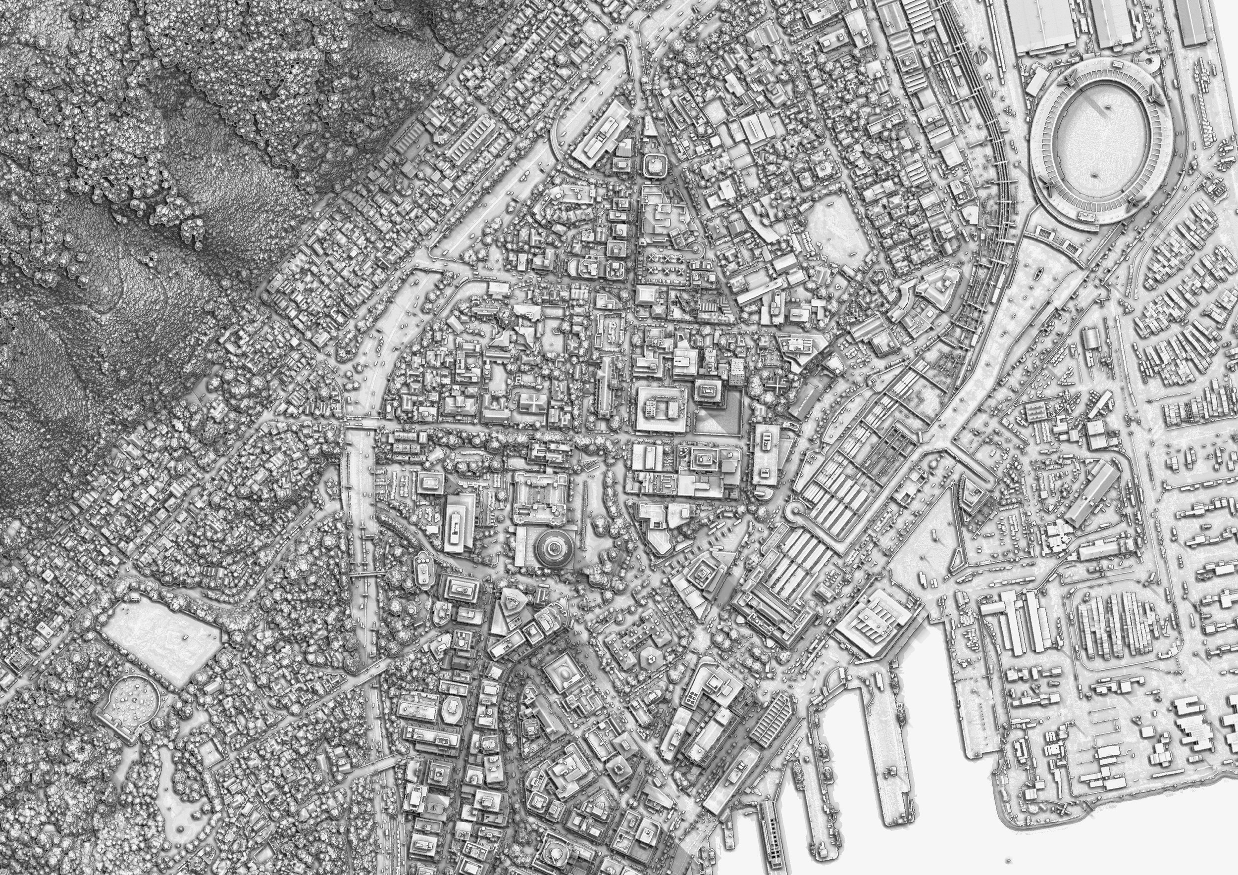
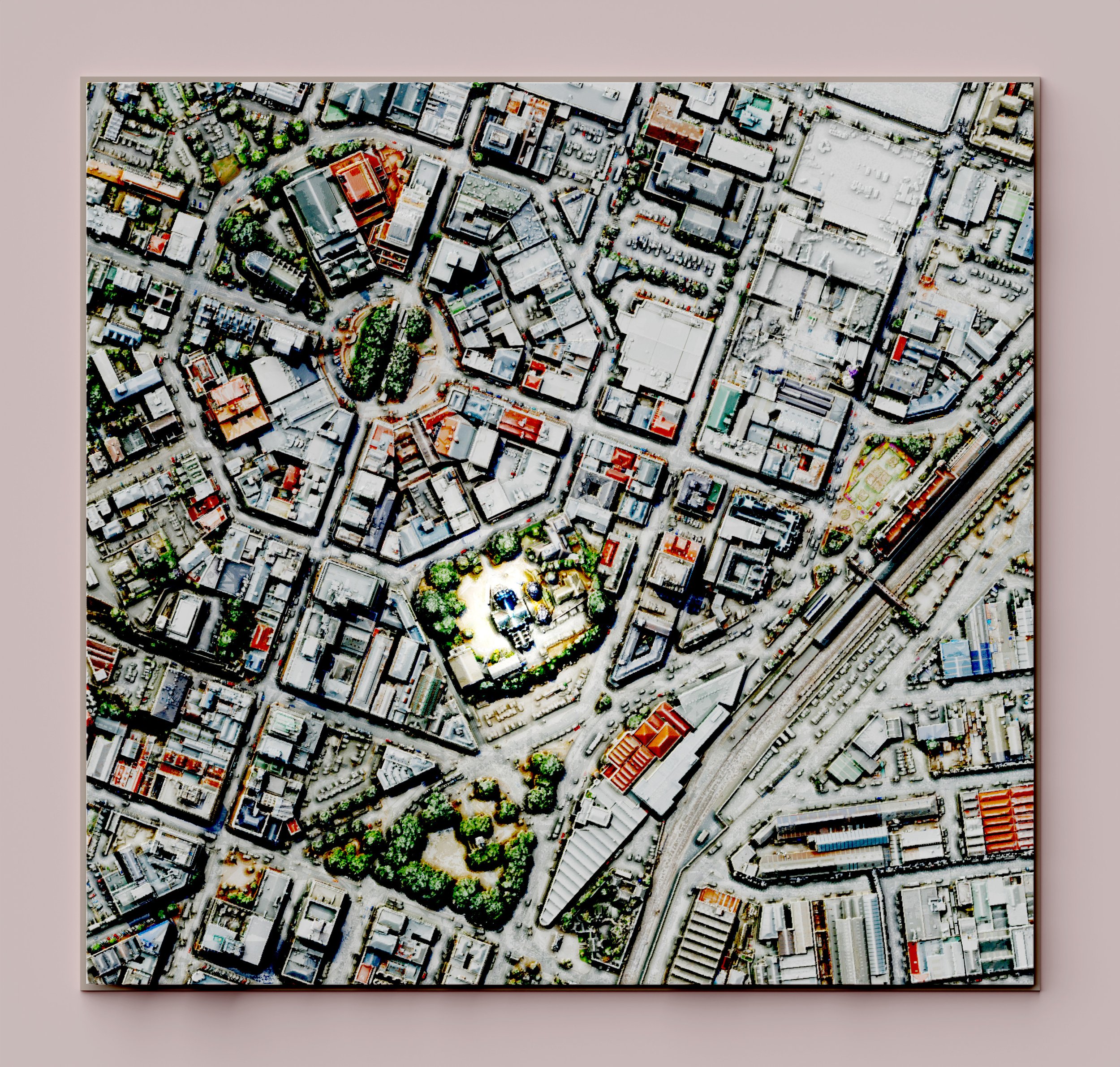
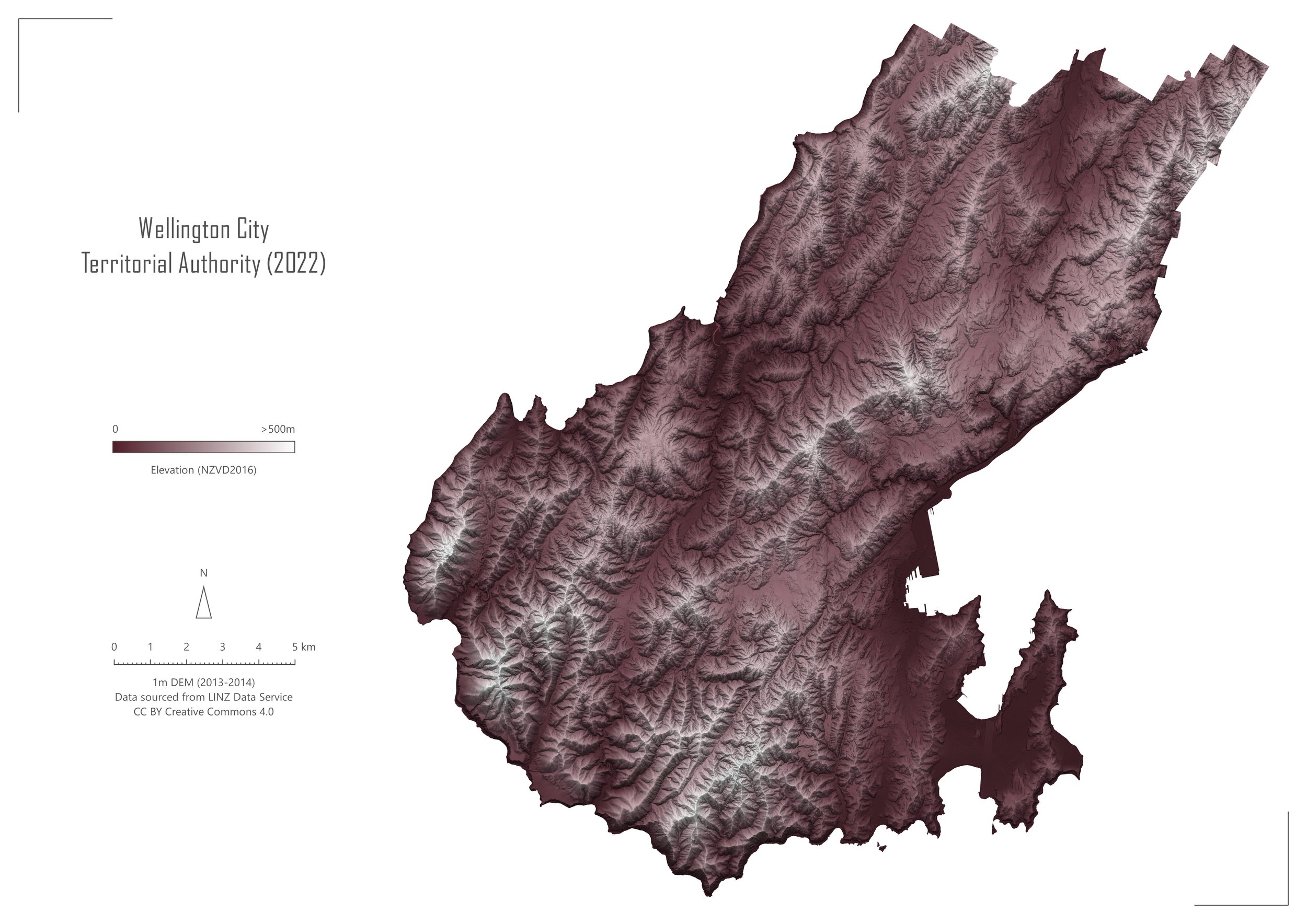
Wellington City - New Zealand

Kerikeri, Northland - New Zealand
Martinborough, Wellington - New Zealand
Mount Robert - Nelson Lakes, New Zealand

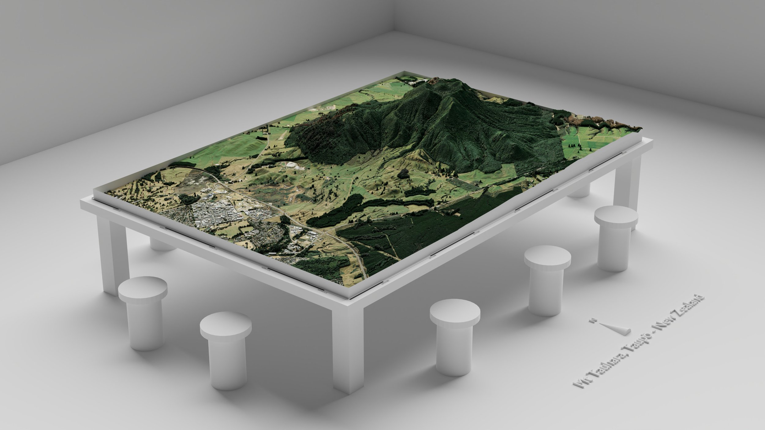
Mt Tauhara, Taupō - New Zealand
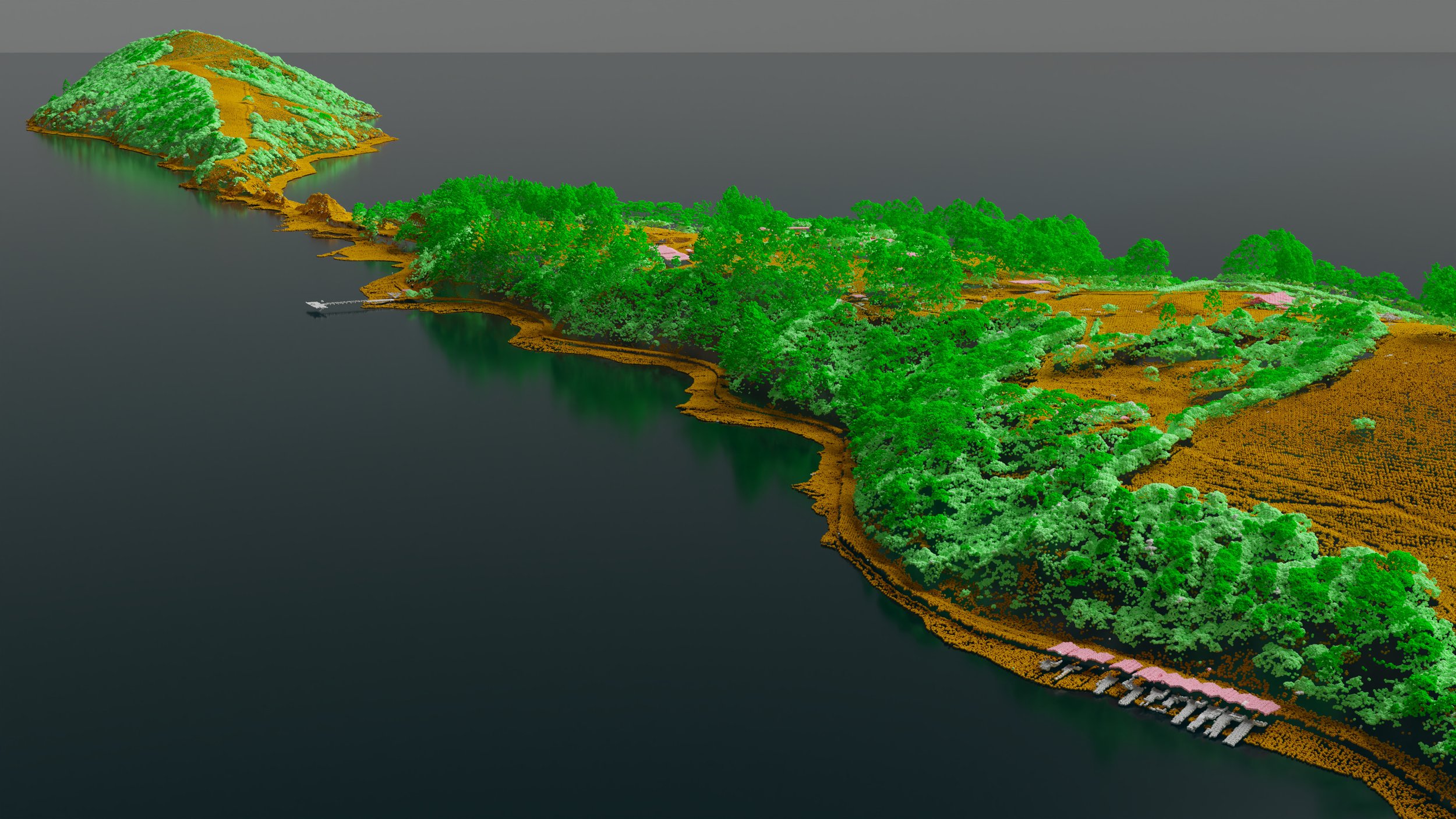
Ōnawe Peninsula, Banks Peninsula - New Zealand
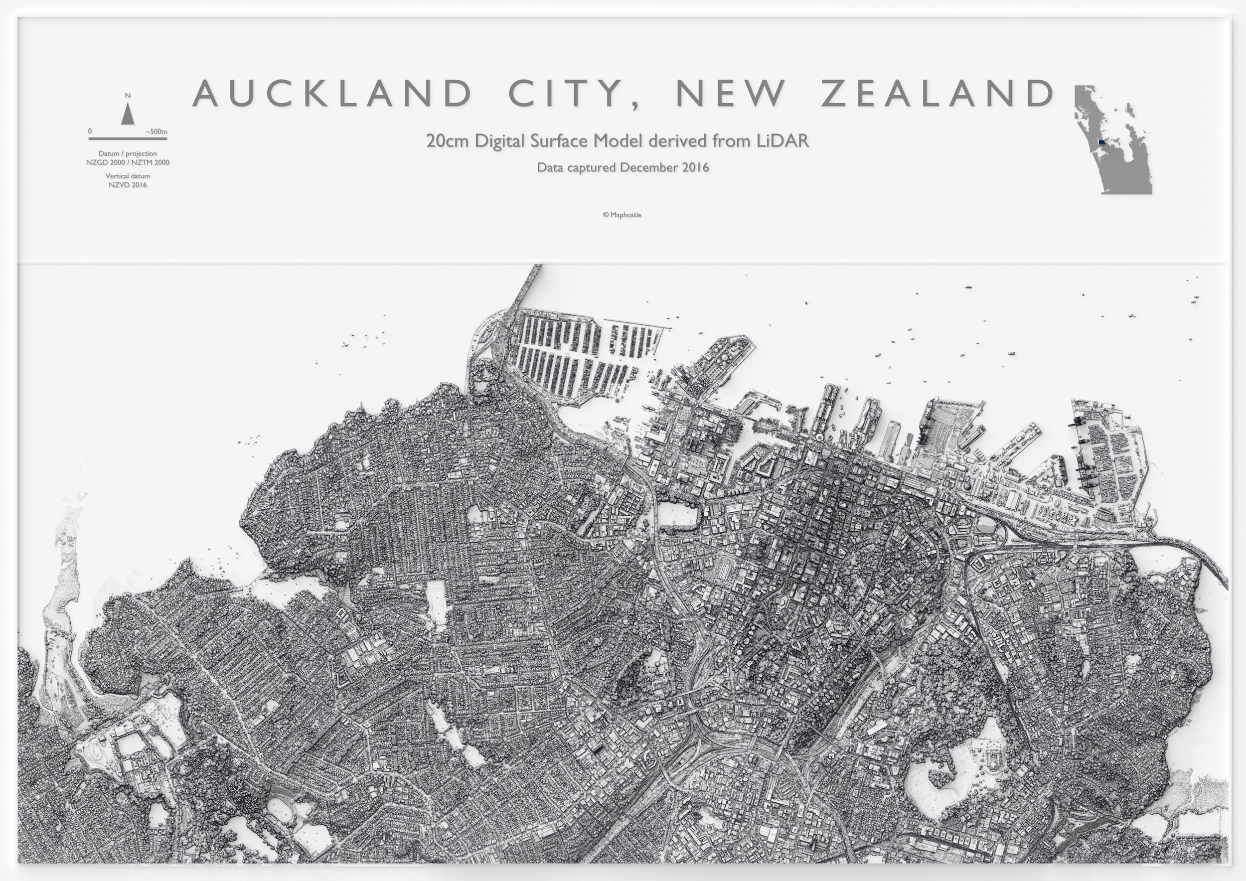
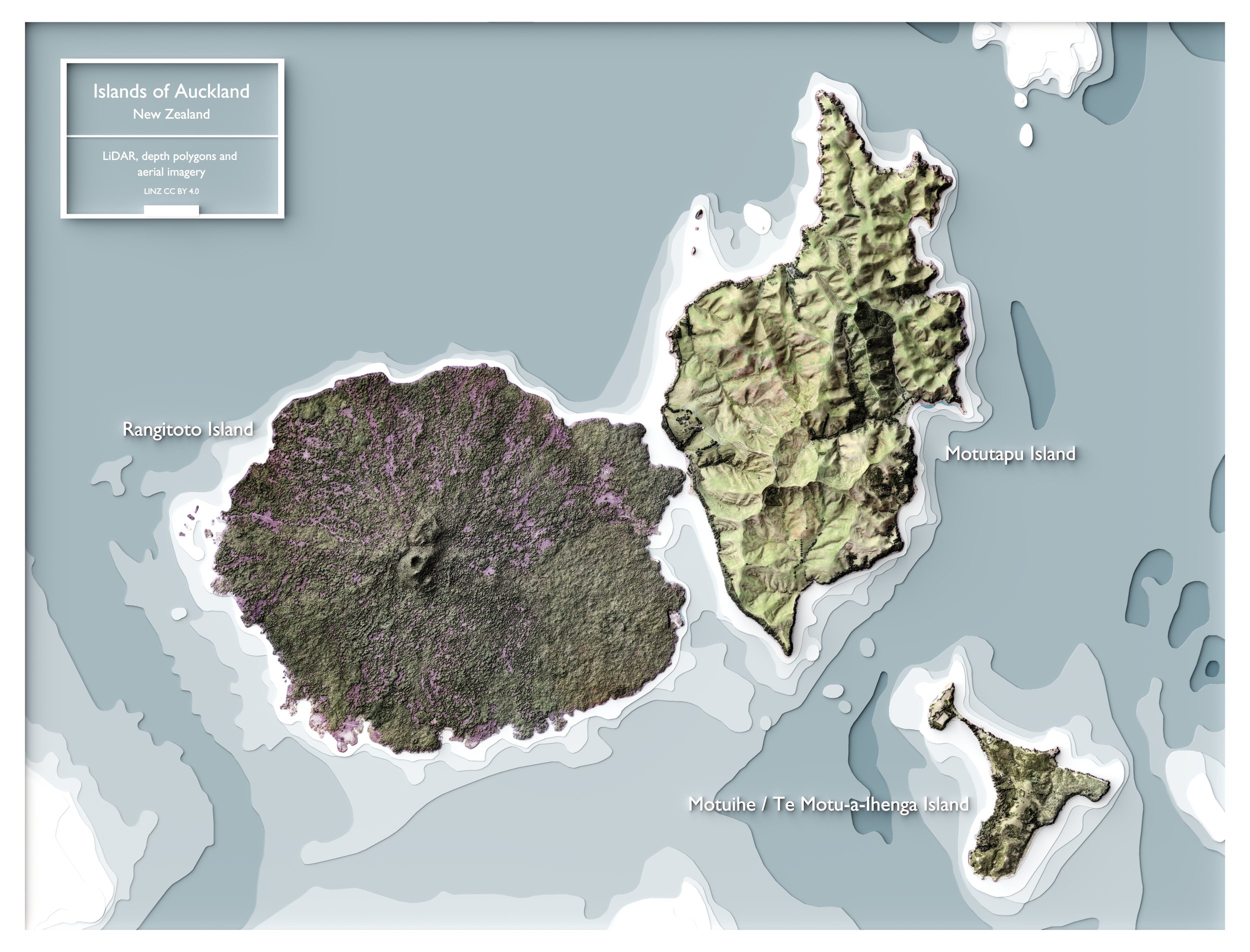
Auckland - New Zealand
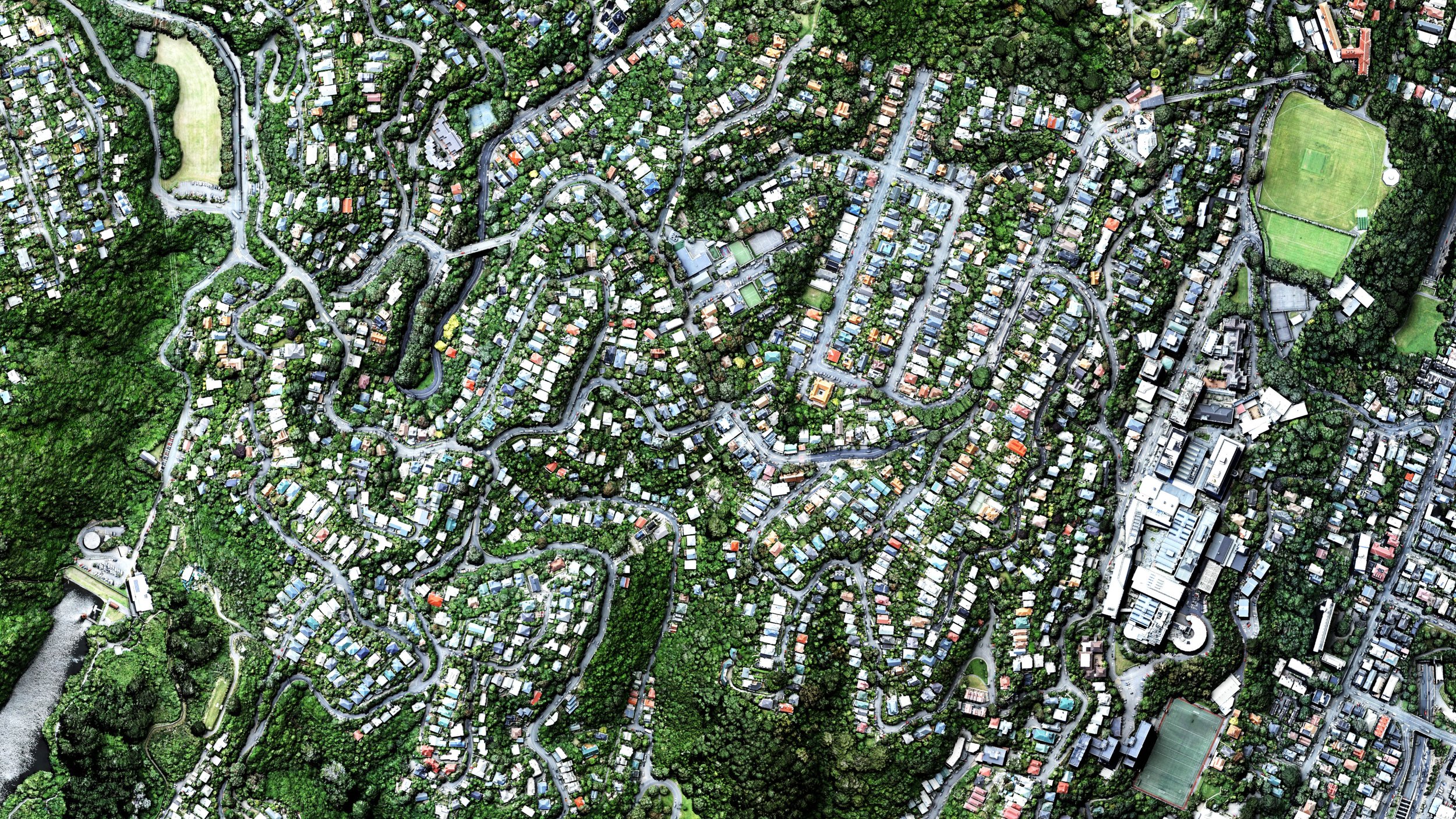
Kelburn, Wellington - New Zealand

Glenbrook Steel Mill, Auckland - New Zealand

Cobb Valley, Tasman - New Zealand

Rotorua Volcanics, Bay of Plenty - New Zealand
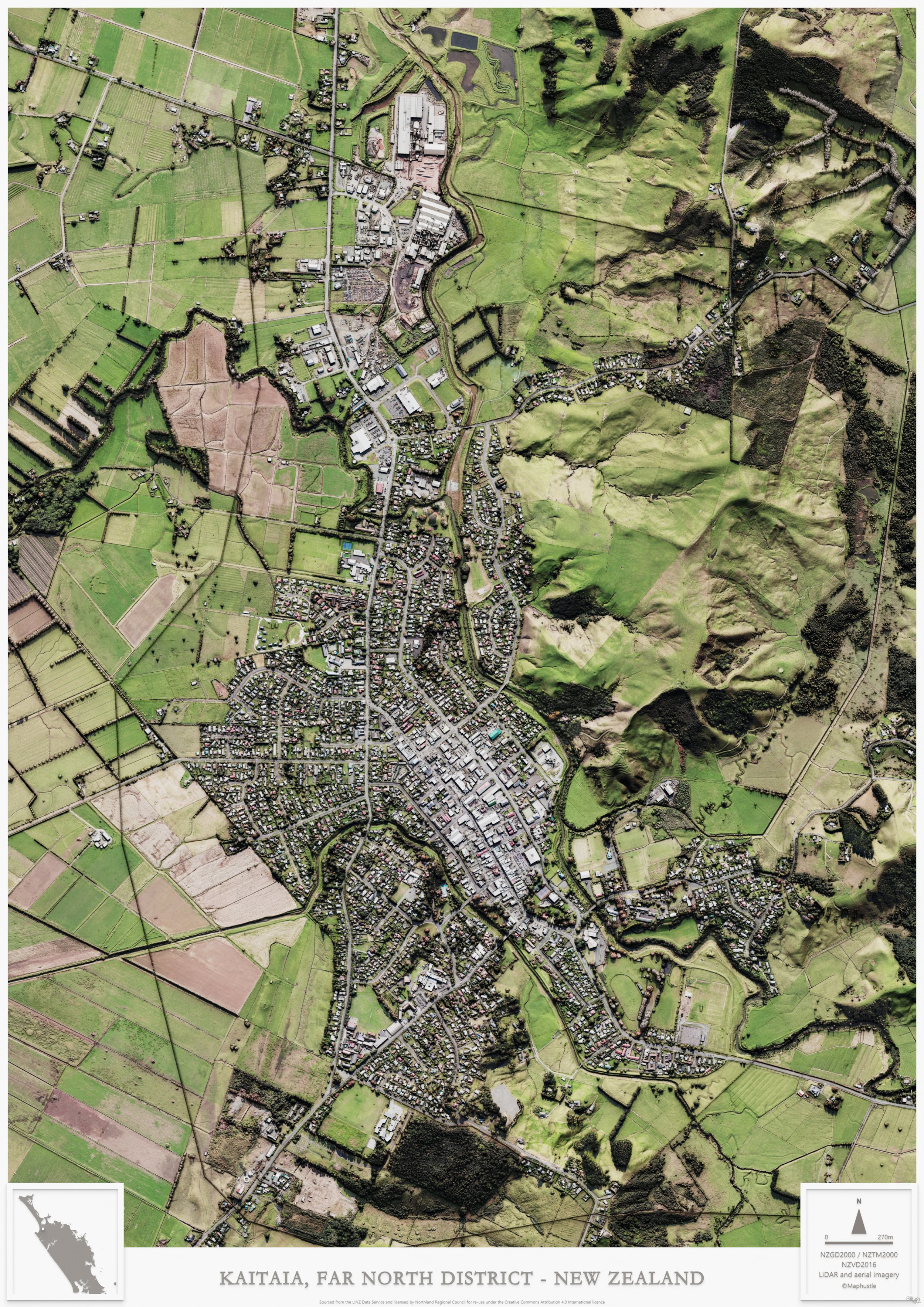
Kaitaia, Far North District - New Zealand
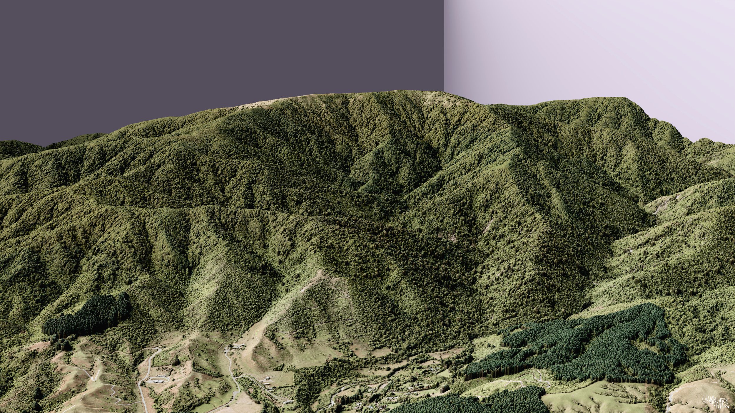
Kapakapanui Track, Kāpiti - New Zealand
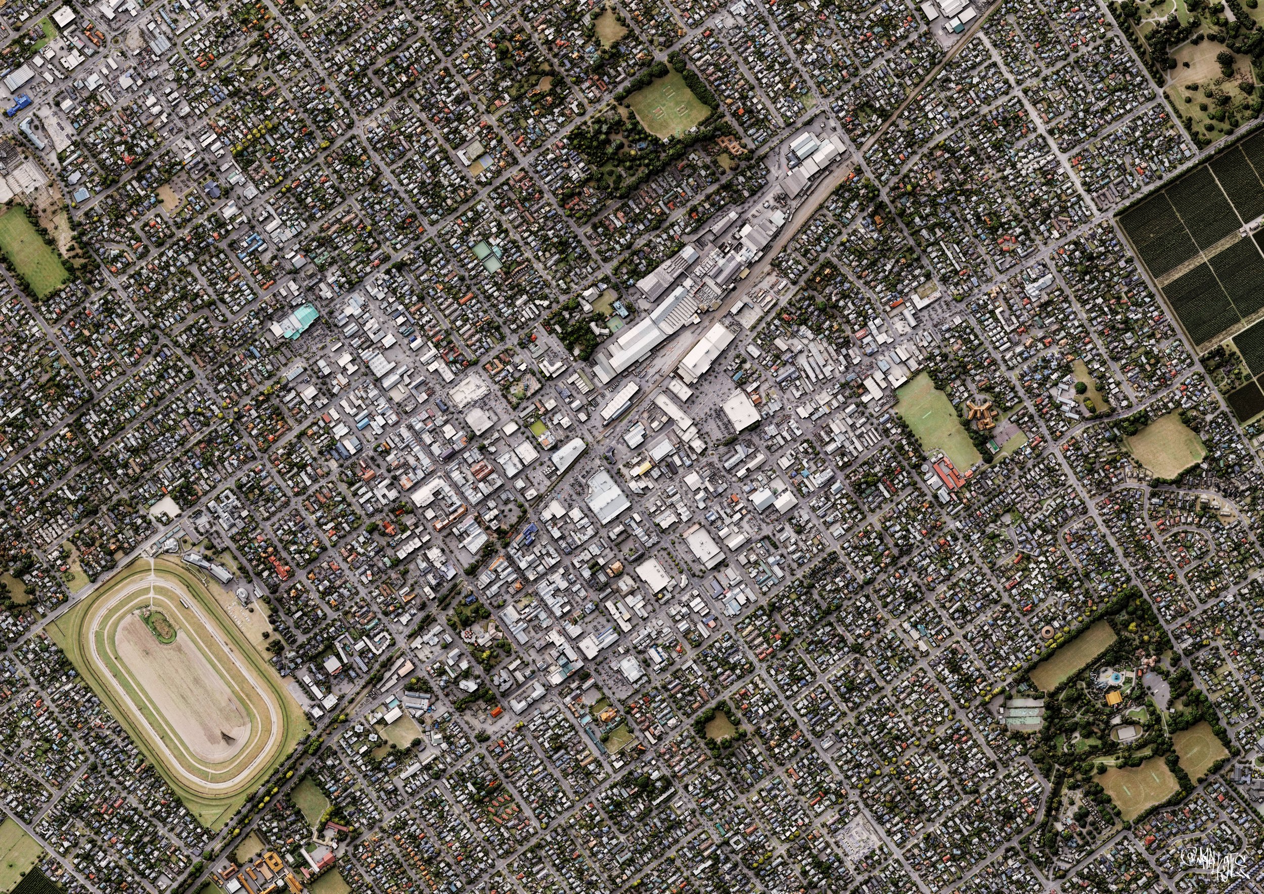
Hastings, Hawke's Bay - New Zealand
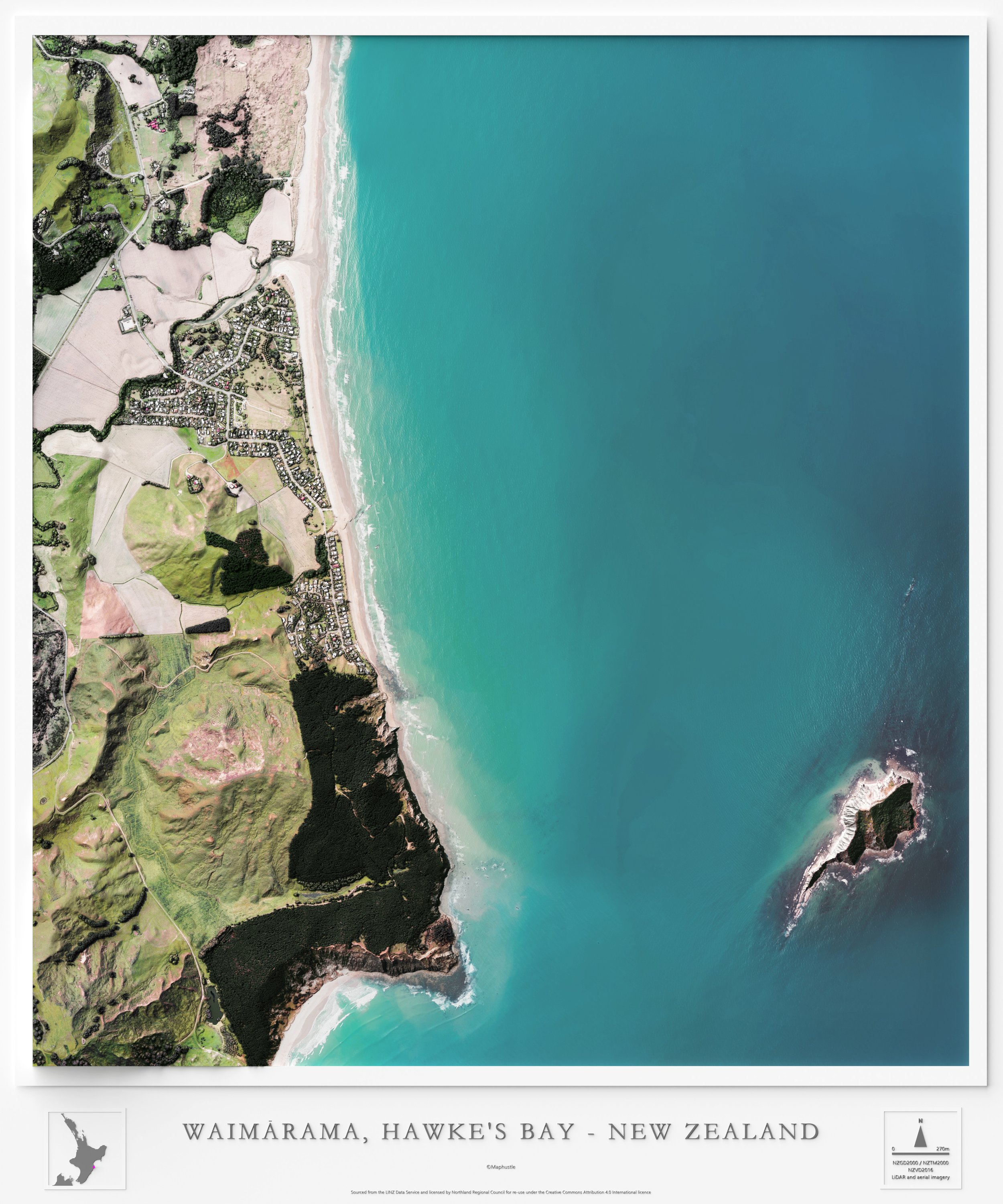
Waimārama, Hawke's Bay - New Zealand

Queenstown, Otago - New Zealand

Matiu / Somes Island, Wellington - New Zealand

Eastbourne, Wellington - New Zealand

Auckland CBD
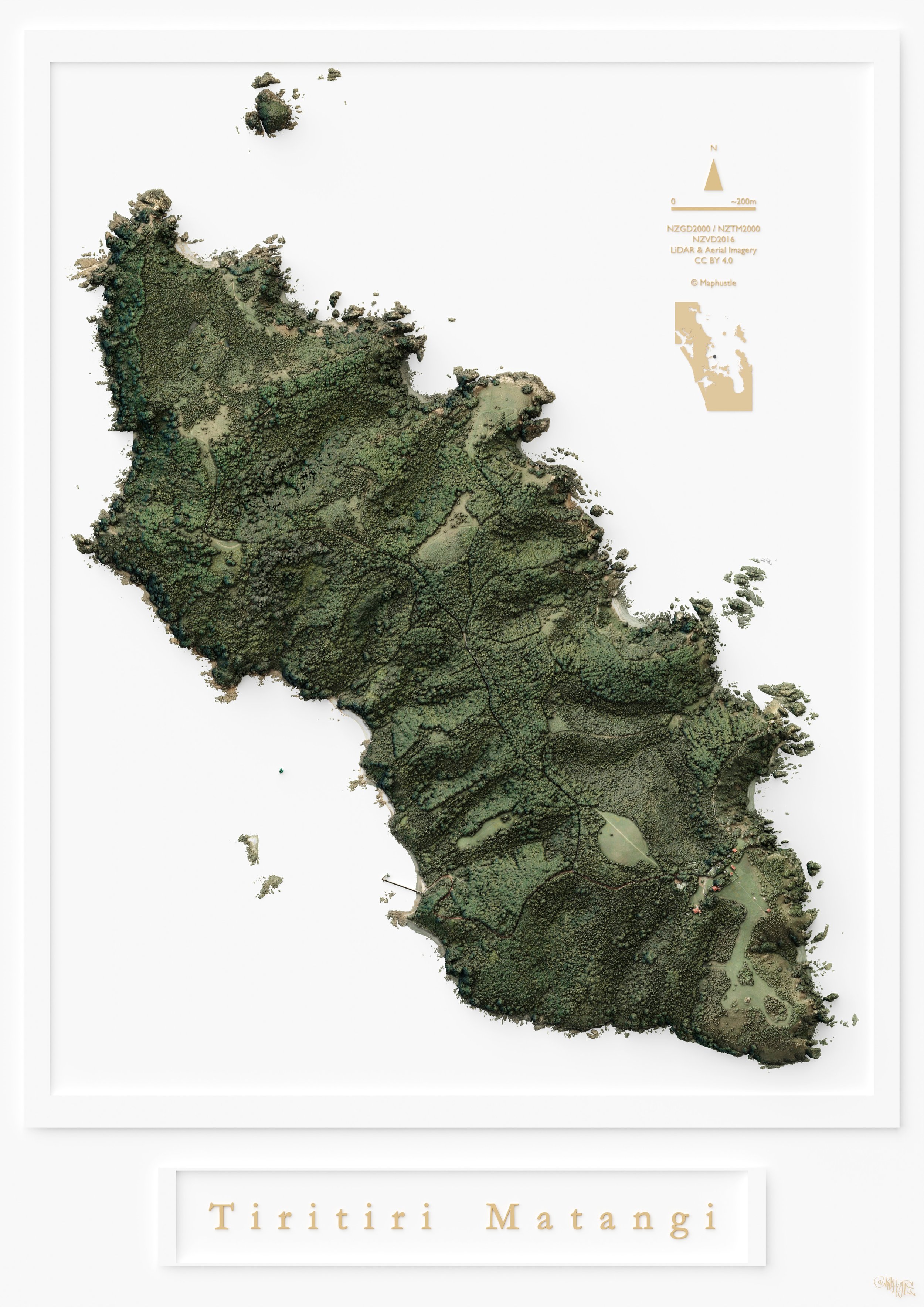
Tiritiri Matangi, Auckland - New Zealand
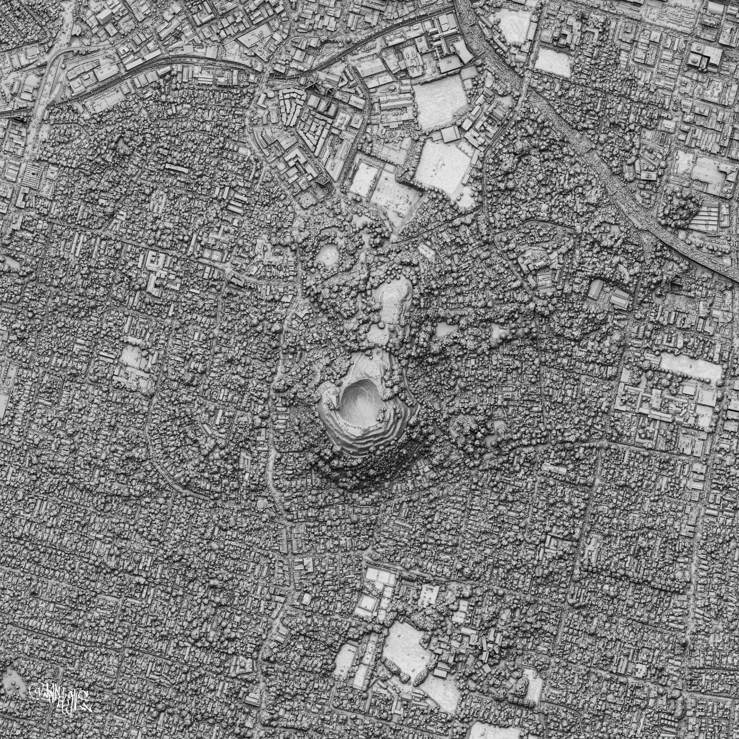
Mt Eden, Auckland - New Zealand
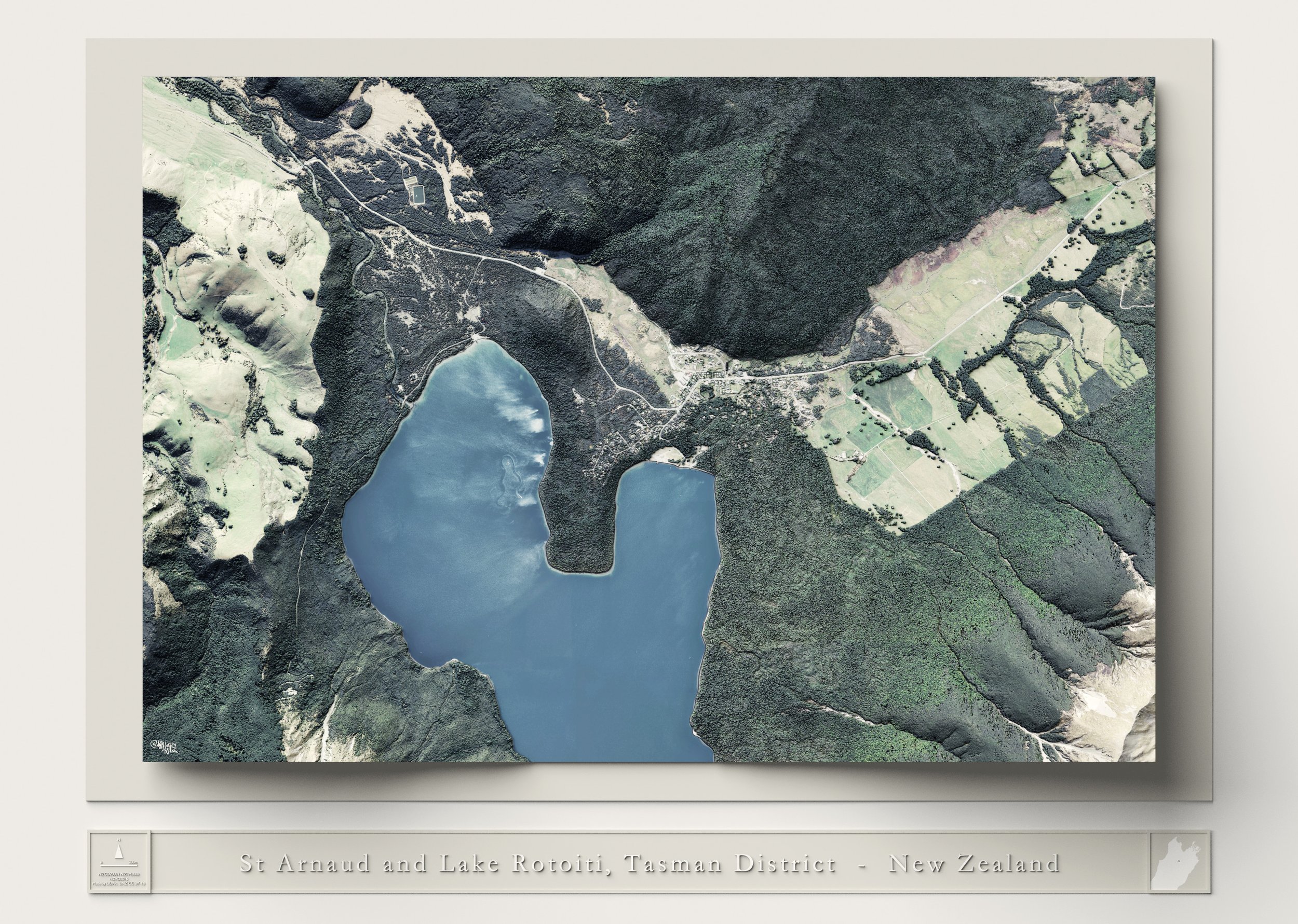
St Arnaud, Tasman - New Zealand
Pohaturoa, Waikato - New Zealand
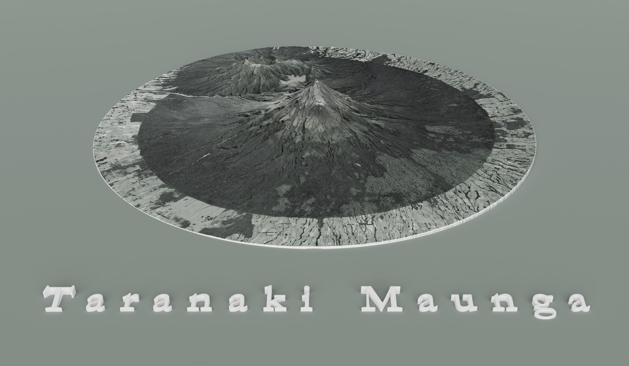
Taranaki Maunga, Taranaki - New Zealand
Auckland - New Zealand

Khandallah, Wellington - New Zealand
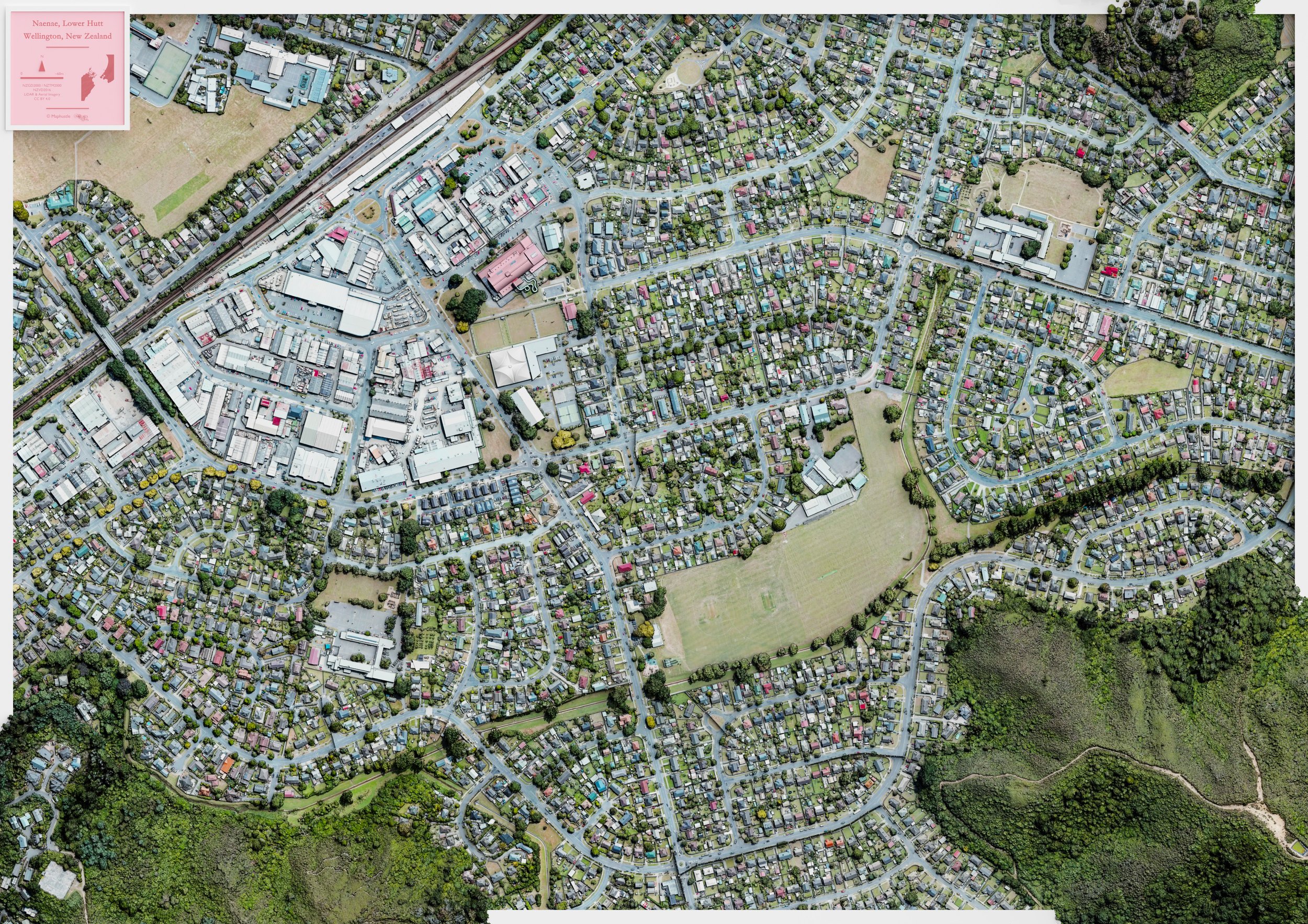
Naenae, Lower Hutt - New Zealand
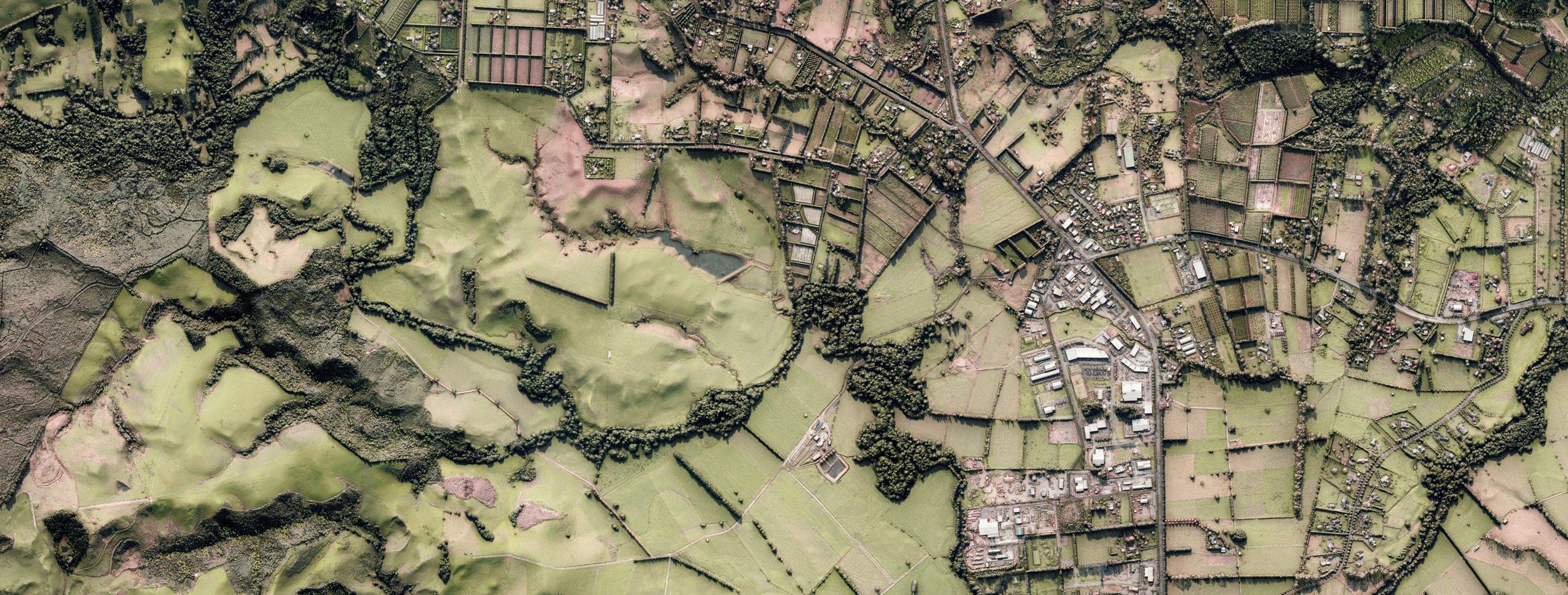
Waikato - New Zealand

Lake Angelus, Tasman - New Zealand
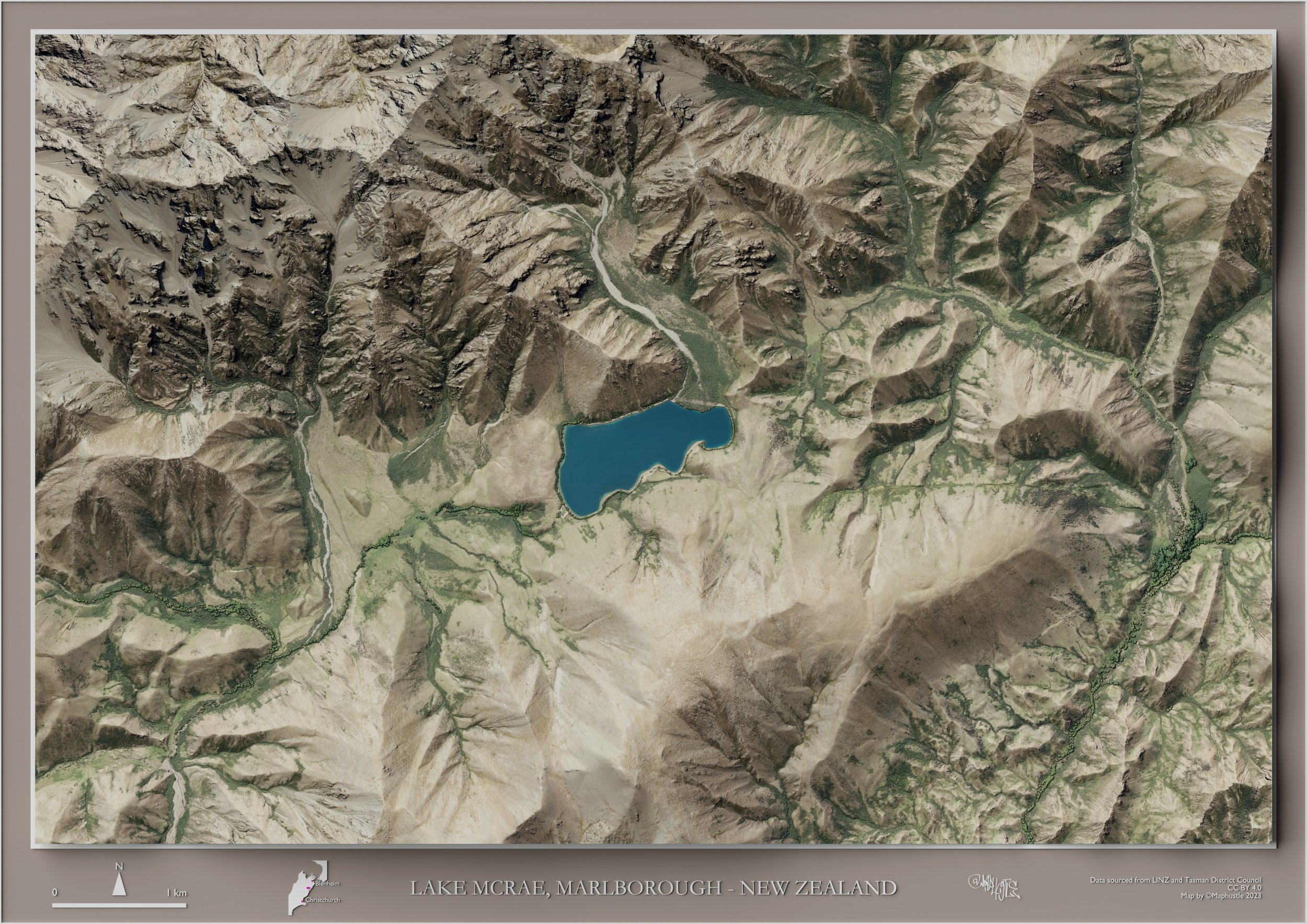
Lake McRae, Marlborough - New Zealand
Nelson - New Zealand
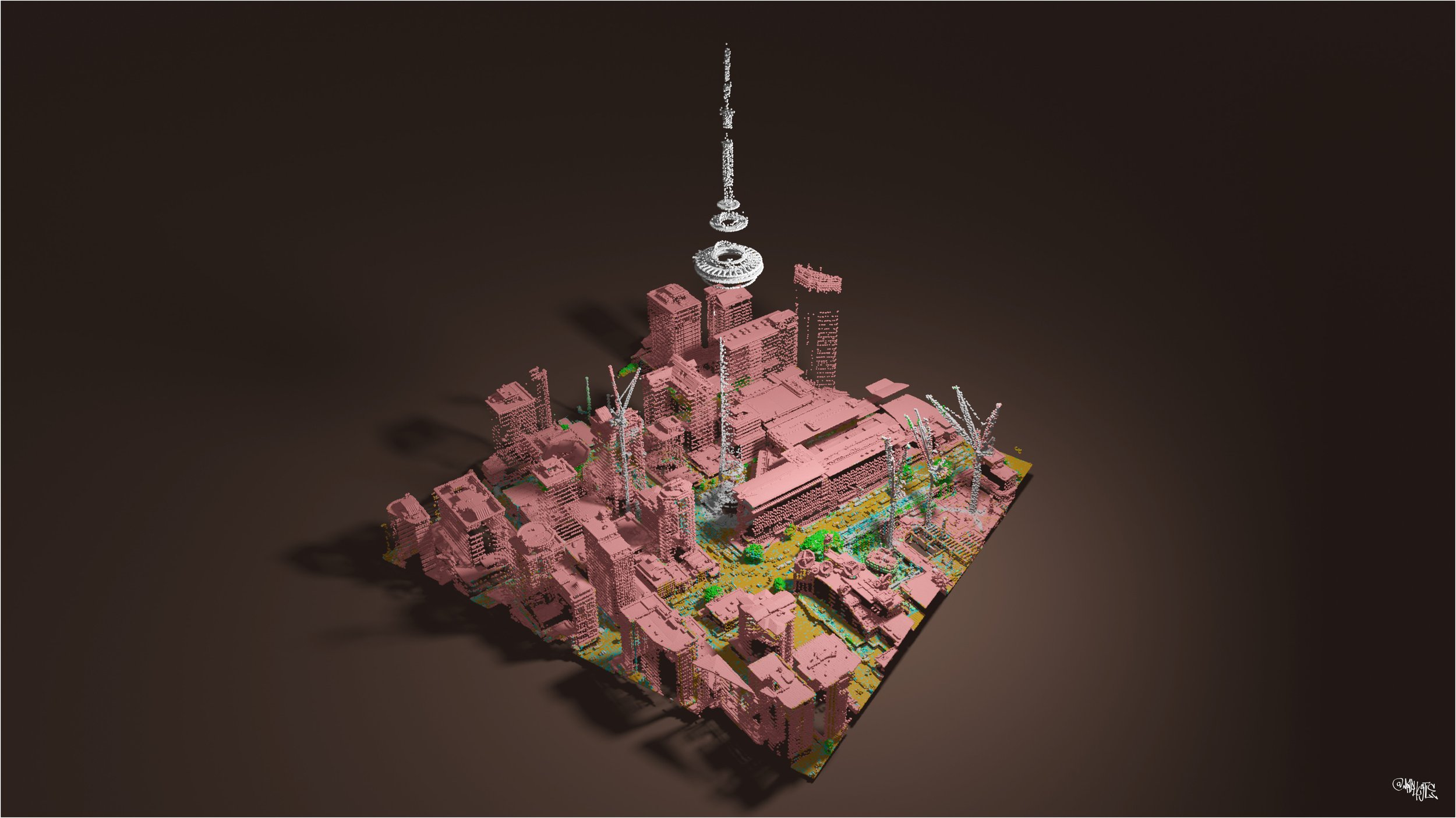
Auckland Sky Tower - New Zealand
Cobb River Valley, Tasman - New Zealand
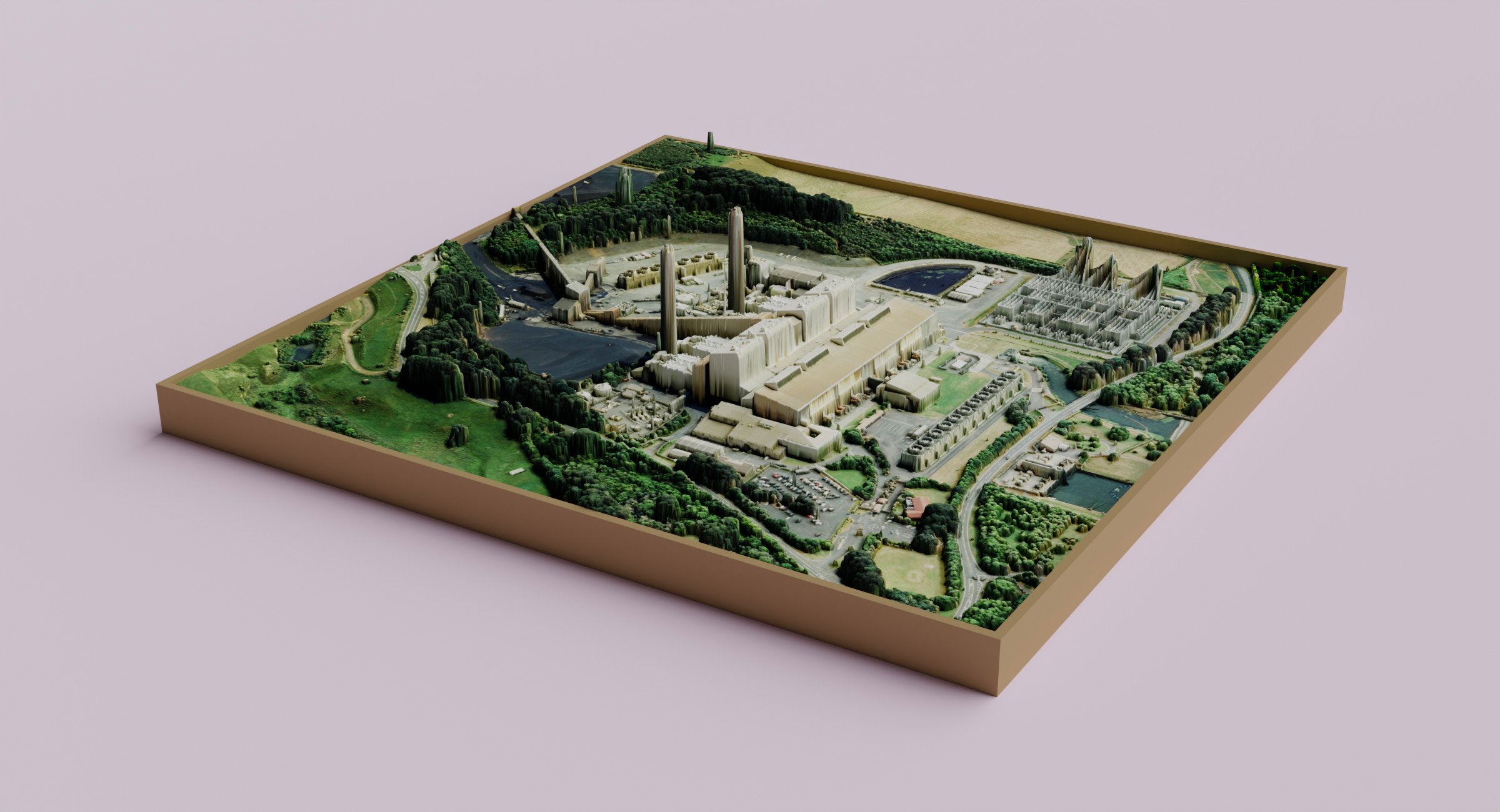
Huntly Power Station, Waikato - New Zealand

Matiu / Somes Island, Wellington - New Zealand
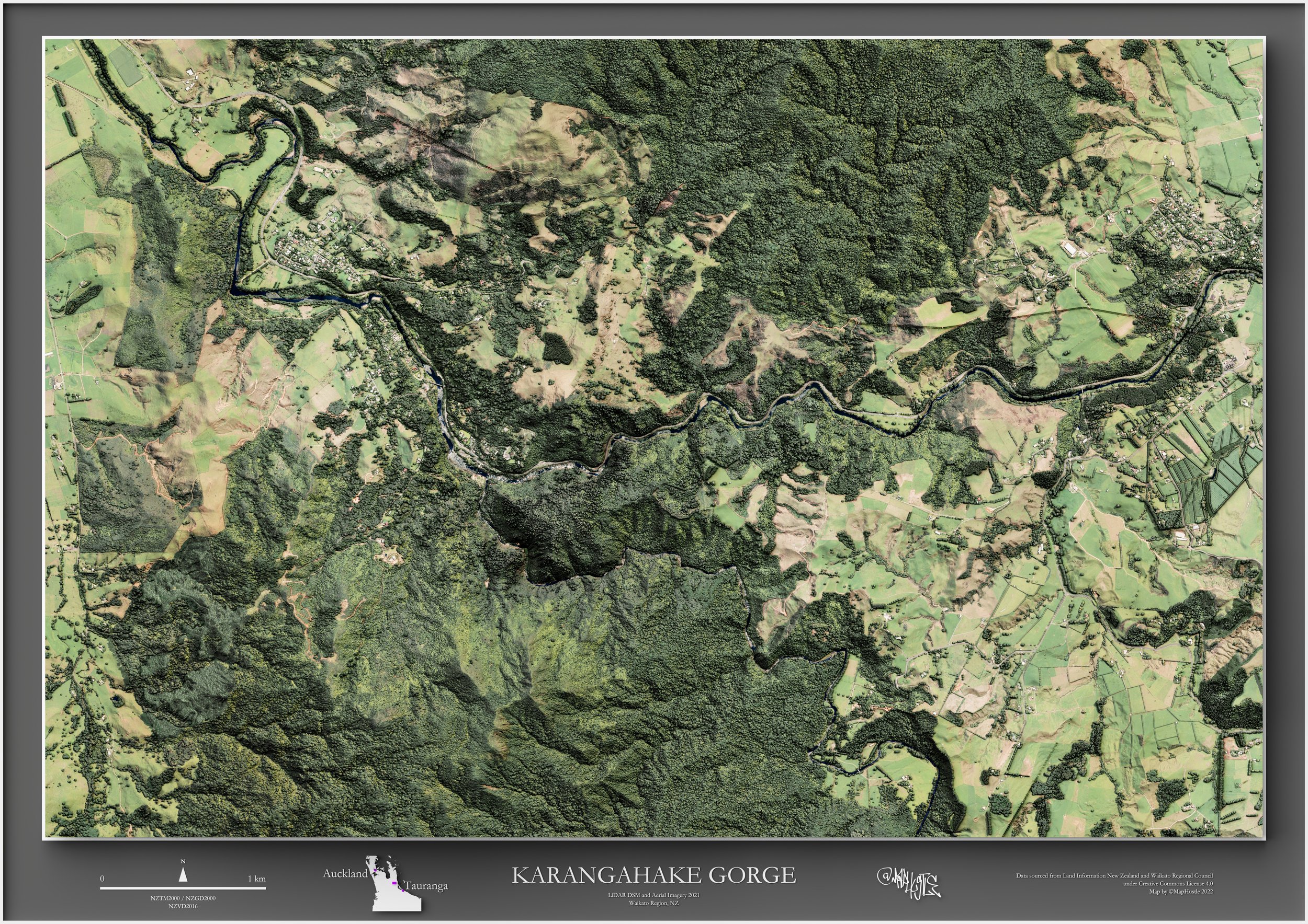
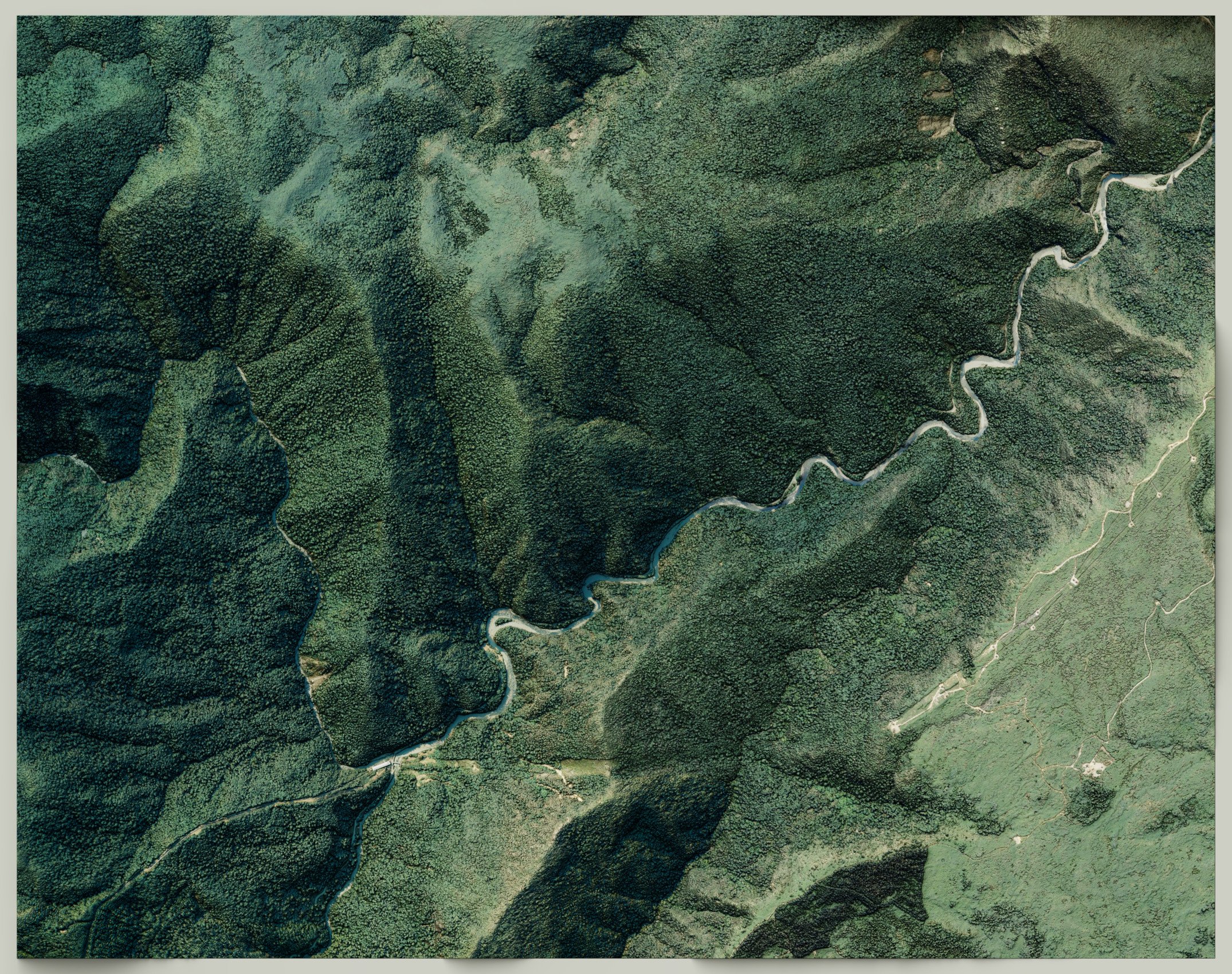
Karangahake Gorge, Waikato - New Zealand
Waikato - New Zealand
Kerikeri, Northland - New Zealand
Relief Shading. Wellington City - New Zealand

Waima (Ure) River, Marlborough - New Zealand
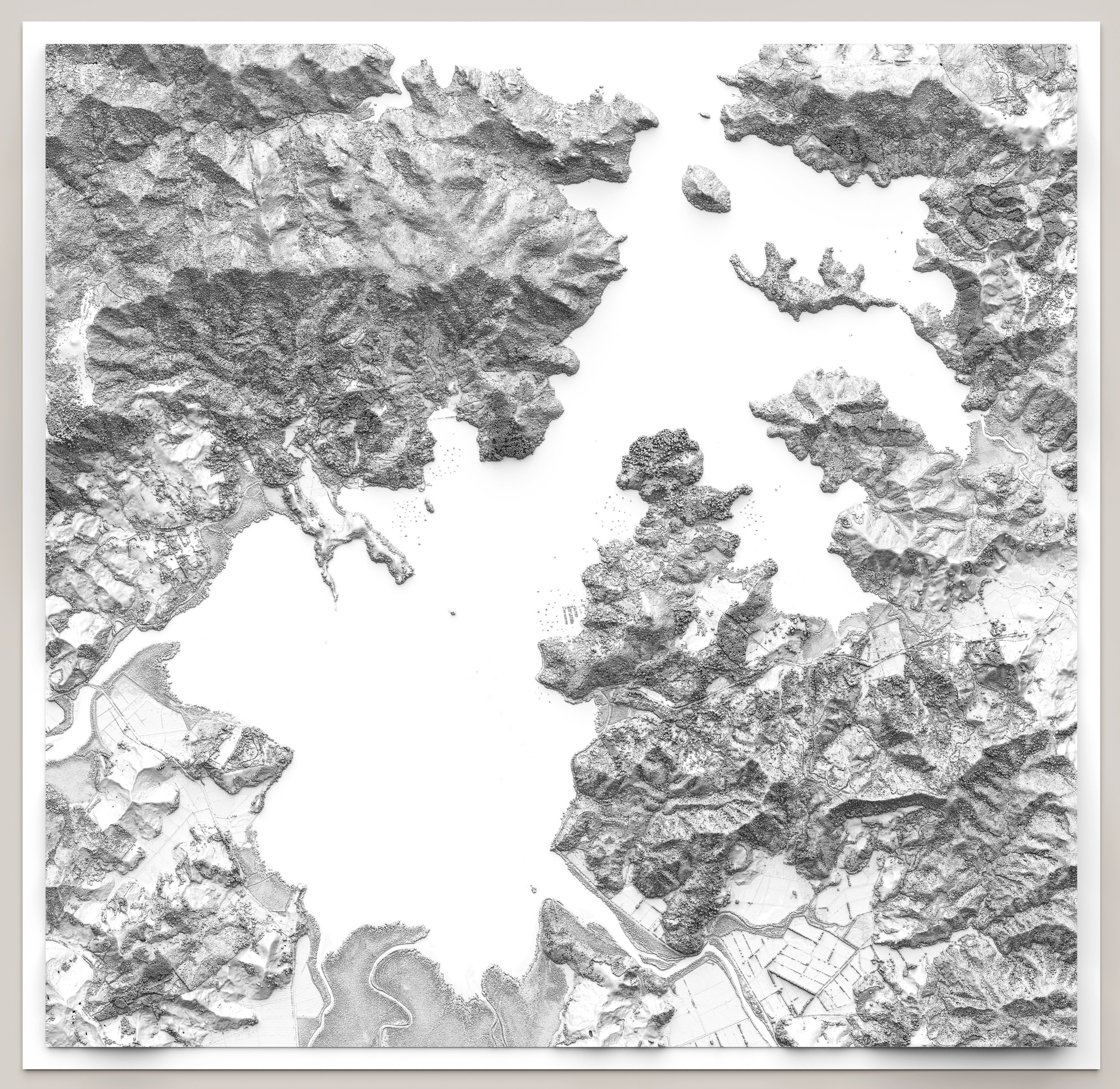
Whangaroa Harbor, Northland - New Zealand

Victoria University of Wellington, Wellington - New Zealand
Little Barrier Island, Auckland - New Zealand
Lake Angelus, Tasman - New Zealand
Wellington - New Zealand

New Plymouth, Taranaki - New Zealand

Scott Base - Antarctica
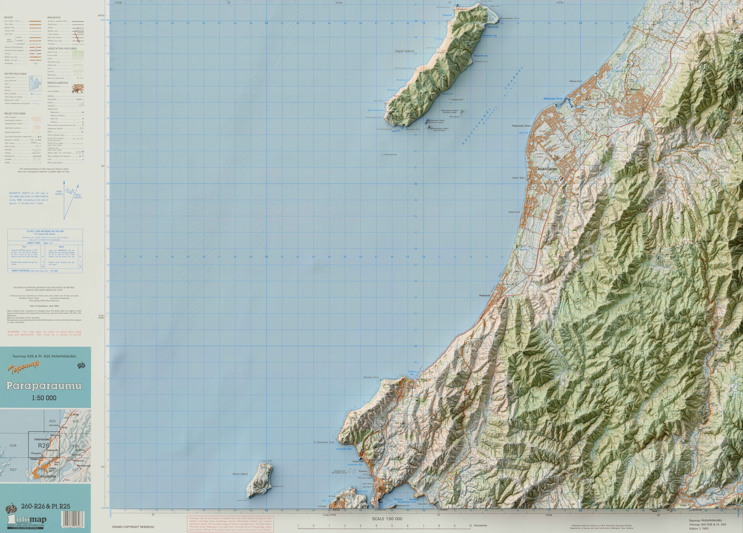
Kapiti, Wellington - New Zealand

Lake Angelus, Tasman - New Zealand

Shadow Map, Wellington - New Zealand
Dunedin, Otago - New Zealand

Taranaki Maunga, Taranaki - New Zealand

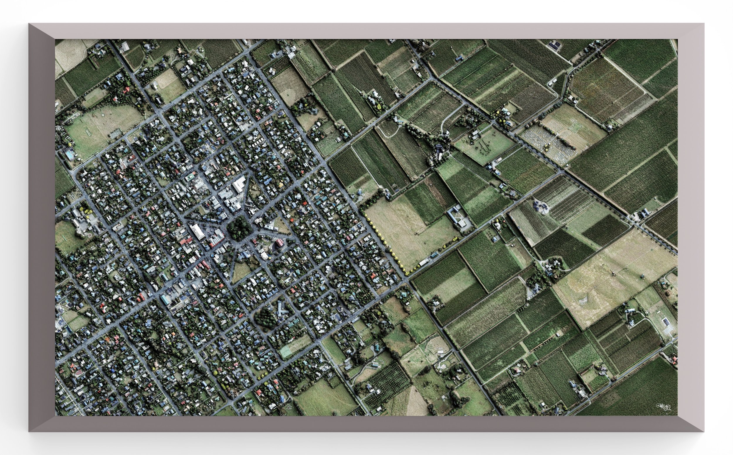
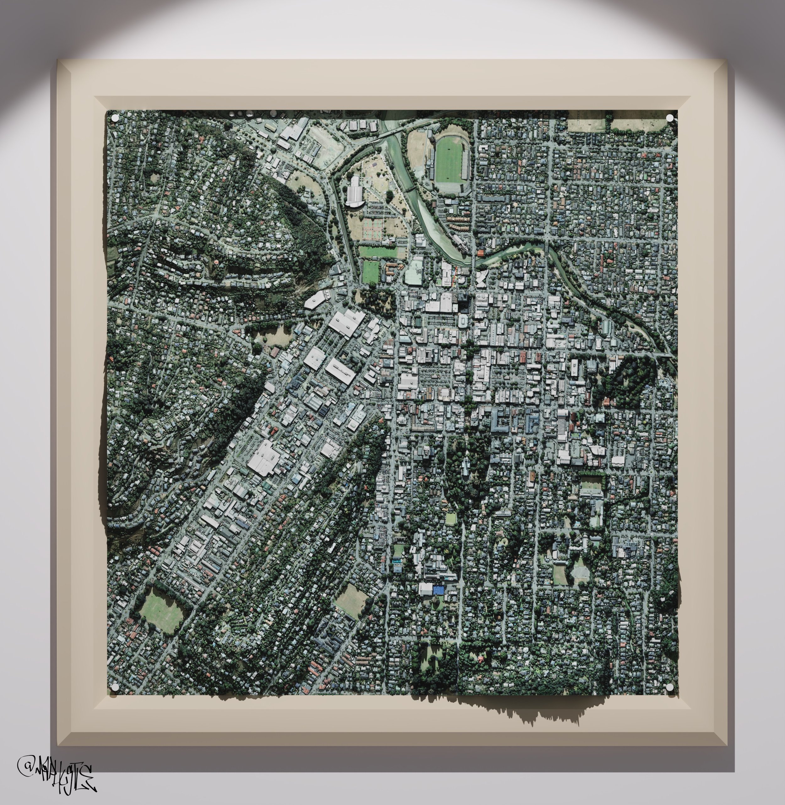
Christchurch, Canterbury, New Zealand

Balclutha, Otago - New Zealand

Petone and Lower Hutt, Wellington - New Zealand
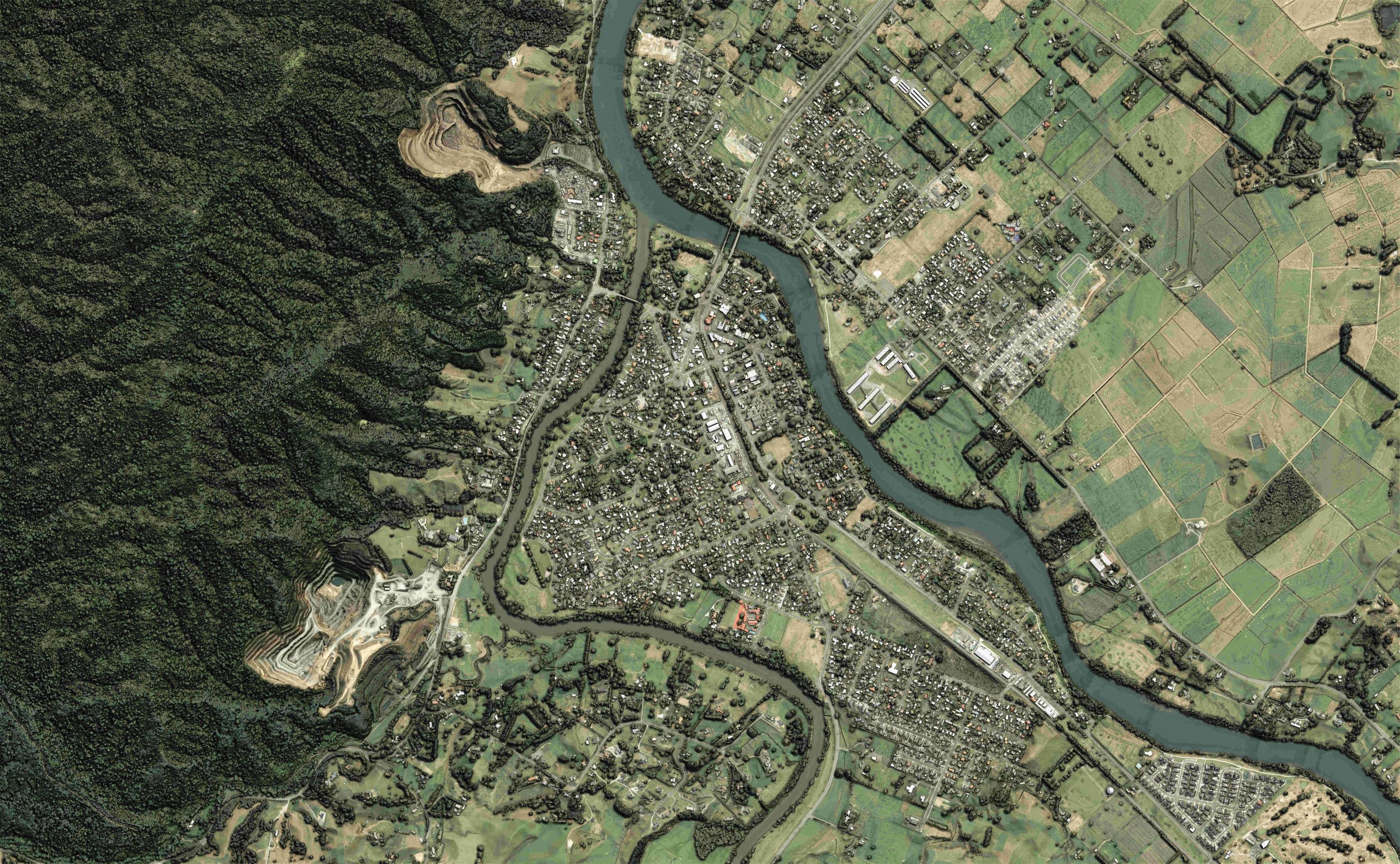
Ngāruawāhia, Waikato - New Zealand

Christchurch, Canterbury - New Zealand

Haast River / Awarua, West Coast - New Zealand
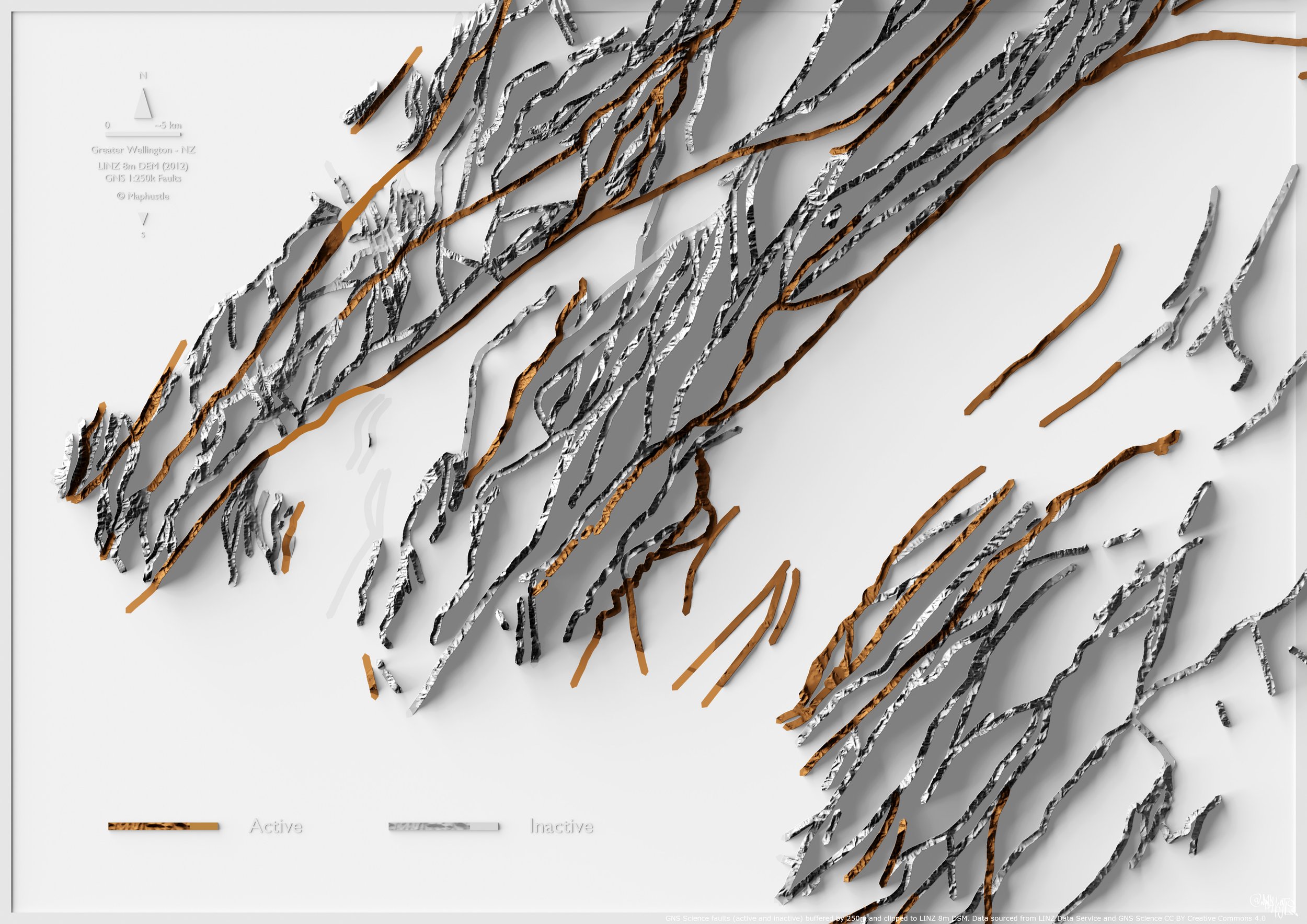
Faults of Wellington - New Zealand
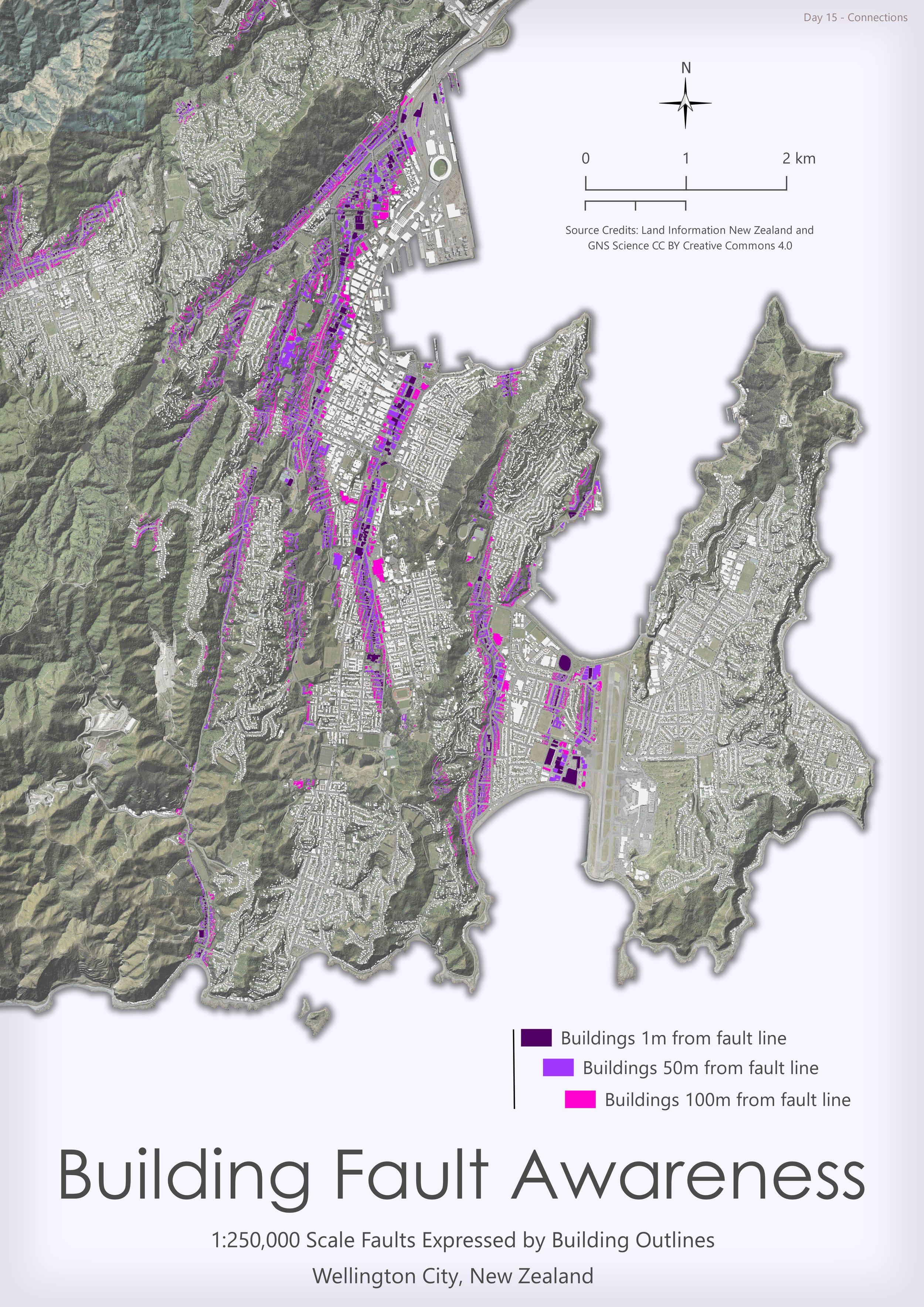
Buildings linked to fault lines - wellington

Routeburn Trail Map, Fjordland and Mt Aspiring National Parks - New Zealand
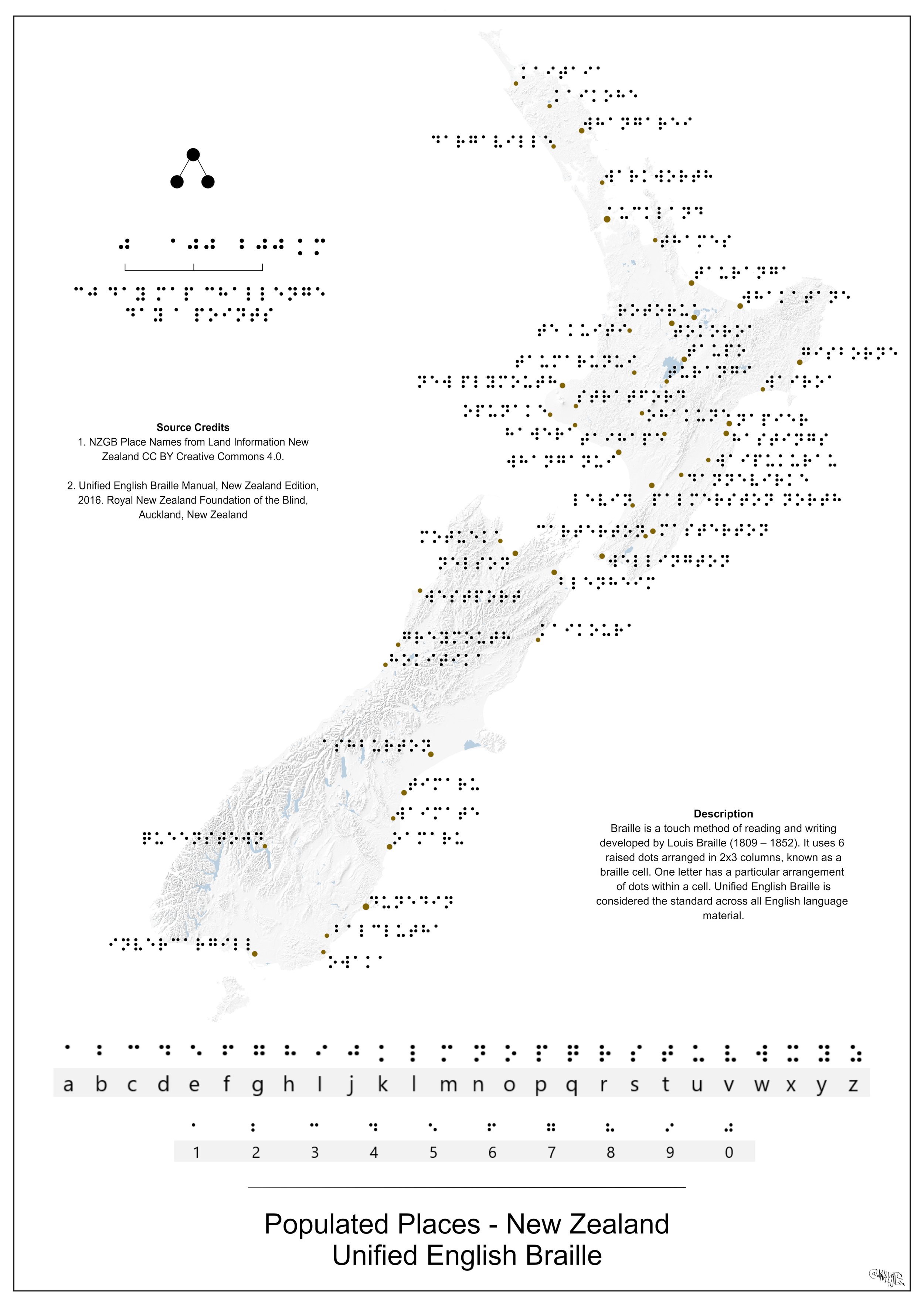
Populated places as Braille cells - New Zealand

NZ Geographic Board Offical/Unofficial Place Names with information on what goes into naming a place in New Zealand

Christchurch City chess board idea

Napier Aquarium, Hawke's Bay - New Zealand

Eastbourne 1969 historic imagery, Wellington - New Zealand
Colourised 1m DEM, Wellington - New Zealand

Wellington City - New Zealand